


National Park · Nan
Si Nan National Park
อุทยานแห่งชาติศรีน่าน
Mountains, River Landscapes & Starry Skies in Southern Nan
Na Muen · Na Noi · Wiang Sa · Northern Thailand
South of Nan city, forested ridges rise above the Nan River — sunrise viewpoints, eroded earth formations, long cliffs and some of the darkest night skies in the province.
A Landscape Shaped by the Nan River
Si Nan National Park (อุทยานแห่งชาติศรีน่าน) is one of Nan Province’s most distinctive protected landscapes, stretching across Na Muen, Na Noi and Wiang Sa districts in southern Nan.
Rather than being defined by a single landmark, Si Nan is a large mountain-and-river landscape shaped by the Nan River, which runs through the park for roughly 60 kilometres. Forested mountain ranges rise on both sides of the river, creating a succession of cliffs, viewpoints, valleys and natural formations.
The park is best known for Doi Samer Dao, Pha Hua Sing, Pha Chu, Sao Din Na Noi, Khok Suea, Kaeng Luang and Pak Nai. Together, they give Si Nan an unusually varied character: sunrise above the mountains, mist over the valleys, dramatic geological formations, river scenery and exceptionally dark night skies.
Come for the view. Stay for the landscape. Look up when the sun goes down.
At a Glance
- ~1,024 km²
- Park area — approximately 640,237.50 rai.
- 2007
- Established 25 May as a national park.
- 60 km
- Nan River corridor through the protected landscape.
- 3 districts
- Na Muen, Na Noi and Wiang Sa, Nan.
- Dark Sky
- Doi Samer Dao — recognised by NARIT.
- Official Name
- Si Nan National Park
- Thai Name
- อุทยานแห่งชาติศรีน่าน
- Location
- Nan Province, Northern Thailand
- Districts
- Na Muen, Na Noi and Wiang Sa
- Area
- Approximately 1,024.38 km² / 640,237.50 rai
- Landscape
- Mountain ranges, forest, cliffs, river valleys and geological formations
- Main River
- Nan River
- Established
- 25 May 2007
- Best Known For
- Doi Samer Dao, Pha Hua Sing, Pha Chu, Sao Din Na Noi and night-sky viewing
- Best Travel Style
- Scenic road trip, camping, sunrise, stargazing, nature and photography
The Department of National Parks, Wildlife and Plant Conservation lists the park at approximately 640,237.50 rai (1,024.38 km²) and describes it as covering parts of Na Muen, Na Noi and Wiang Sa.
Why Visit Si Nan National Park?
Si Nan is different from Nan’s better-known high mountain destinations farther north. Here, the landscape is strongly connected to the Nan River. The river cuts through the protected area while long mountain ridges rise on both sides, creating broad views across southern Nan.
The park is particularly attractive for travellers who want to combine several experiences in one journey:
- Sunrise above a sea of mountains
- Camping beneath a dark night sky
- Long-distance mountain views
- River landscapes
- Geological formations
- Forest and wildlife
- Photography
- A slower, more nature-focused side of Nan
The Tourism Authority of Thailand specifically highlights Doi Samer Dao as a place suited to camping, stargazing and watching the sunrise.
The Landscape
Mountains, forest and river at scale
Si Nan National Park is dominated by complex mountain ranges running broadly north to south. The Nan River forms one of the park’s defining geographic features, flowing through the landscape and creating a natural corridor between forested mountains.
The park reaches elevations of more than 1,200 metres in its higher areas. The combination of mountain ridges, river valleys and exposed cliffs gives the landscape considerable visual variety. From elevated viewpoints, the Nan River can often be seen winding through the lower landscape far below.
This relationship between mountains, forest and river is what gives Si Nan its distinctive sense of scale.
Doi Samer Dao
The park’s most famous viewpoint
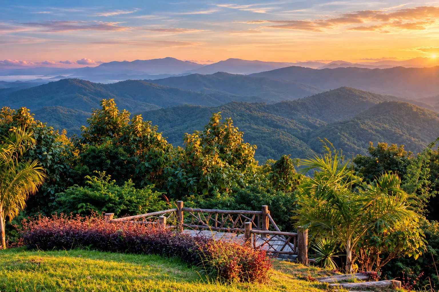
Doi Samer Dao is the signature destination of Si Nan National Park. The broad ridge provides panoramic views over the surrounding mountains and valleys and has become one of Nan’s best-known places for sunrise, sunset, camping and stargazing.
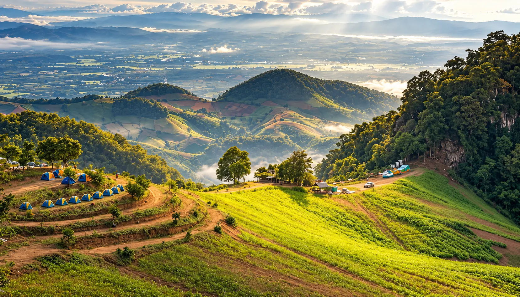
Early morning is particularly atmospheric. When weather conditions are favourable, low cloud and mist can settle in the valleys, creating the appearance of a sea of mist beneath the viewpoint.
At night, the location offers a completely different experience. Doi Samer Dao has been recognised by the National Astronomical Research Institute of Thailand (NARIT) as a Dark Sky Park, reflecting its suitability for night-sky observation.
- Best experience
- Stay overnight if you can. Sunset → stars → sunrise → morning mist is one of the defining experiences of Si Nan.
Pha Hua Sing
ผาหัวสิงห์ · a mountain viewpoint with a distinctive silhouette
Pha Hua Sing is another important viewpoint in the Doi Samer Dao area. The name refers to the distinctive shape of the cliff, which resembles a lion’s head.
From the viewpoint, travellers can look across the surrounding mountain landscape and, under clear conditions, see the Nan River and areas of Na Noi and Wiang Sa.
Photographers love the layered depth: foreground cliffs, forested ridges and the lower Nan River valley across the horizon.
Pha Chu
ผาชู้ · cliffs above the Nan River
Pha Chu is one of the most recognisable landscapes in Si Nan National Park. The large cliff rises above the surrounding forest and provides a different perspective from Doi Samer Dao.
The area is associated with a traditional local love legend involving Chao Eung Phueng, Chao Chan Pha and Chao Juang. The story has become part of the cultural identity surrounding Pha Chu, although it should be understood as local folklore rather than historical documentation.
Pha Chu is also associated with a remarkably long national flagpole system, one of the distinctive features of the site. For travellers, however, the main attraction remains the landscape: a dramatic cliff overlooking the forest and the winding Nan River.
Sao Din Na Noi
เสาดินนาน้อย · a landscape created by erosion
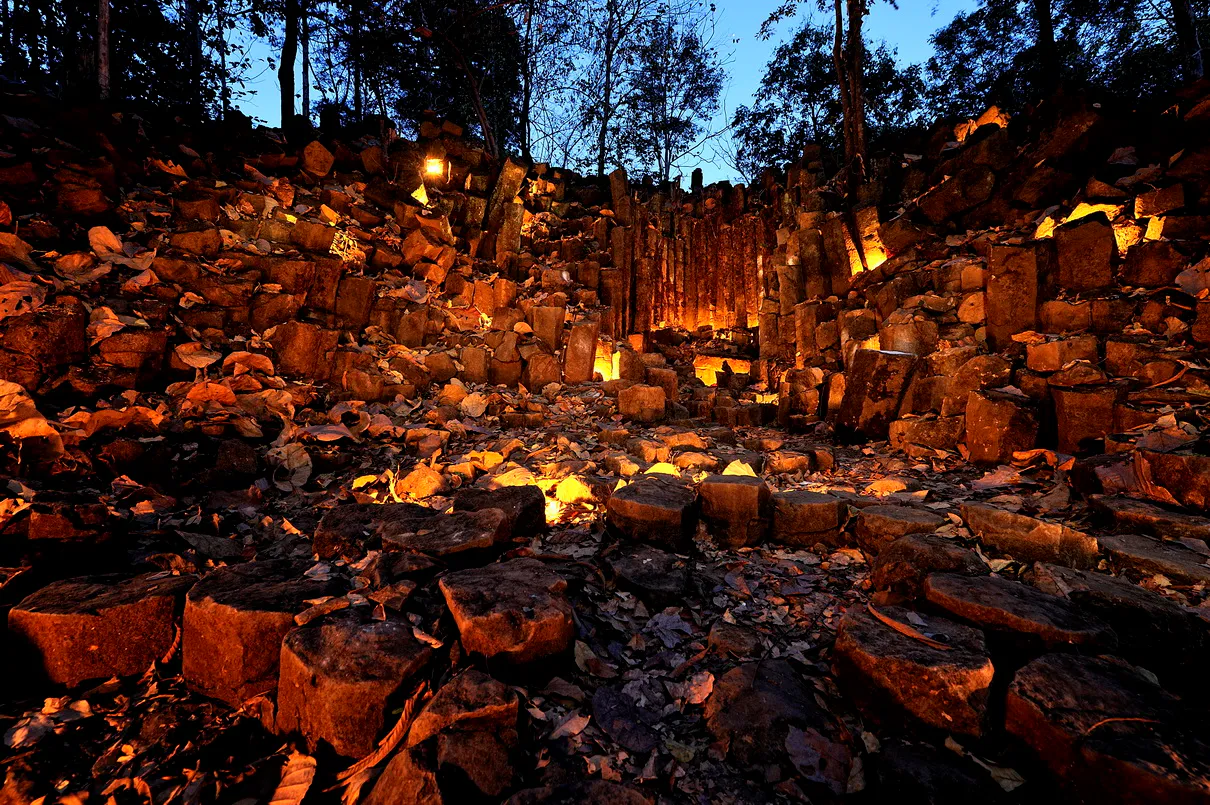
Sao Din Na Noi is one of the most unusual natural formations associated with southern Nan. Instead of a conventional mountain landscape, visitors encounter tall columns and formations of exposed earth created through long-term natural erosion — a landscape that feels very different from the surrounding forested mountains.
The Tourism Authority of Thailand identifies Sao Din Na Noi as one of Nan’s notable natural attractions and includes it in suggested itineraries together with Si Nan National Park.
Khok Suea
คอกเสือ
Khok Suea is another natural formation in the southern Nan landscape. Located in the wider area associated with Sao Din Na Noi, it forms part of the geological and scenic character of the region.
Together, Sao Din Na Noi and Khok Suea make an interesting contrast with the forested mountain viewpoints farther inside the park — inviting visitors to look closely at the land itself.
Kaeng Luang
แก่งหลวง · the Nan River in motion
Kaeng Luang is a section of the Nan River characterised by rocky rapids and river formations. The appearance of the river changes considerably according to season and water level.
During periods of higher water, the river can become powerful and fast-moving. During drier conditions, exposed rocks and sections of riverbank become much more visible.
Pak Nai
Where the landscape opens into water
Pak Nai, in Na Muen District, lies at the southern end of the park’s broader landscape and is associated with the large body of water created upstream of Sirikit Dam.
The landscape here is quite different from the mountain viewpoints around Doi Samer Dao. Instead of looking across narrow mountain valleys, visitors encounter a broad water landscape surrounded by hills.
Local fishing communities and floating accommodation have traditionally been part of the character of Pak Nai, while boat trips provide another way of experiencing the surrounding scenery. The site is also an important connection point for travel toward Uttaradit.
Forests & Wildlife
A watershed forest above the Nan River
Si Nan is primarily a forested mountain ecosystem and an important watershed landscape for the Nan River. The park contains several forest types, including mixed deciduous forest, deciduous dipterocarp forest and dry evergreen forest. A variety of native trees, bamboo and orchids can be found within the park.
Wildlife recorded in the wider park ecosystem includes mammals such as:
- Wild boar
- Northern red muntjac
- Common palm civet
- Asiatic wild dog
- Other forest mammals
The park is also known for birdlife, including Siamese fireback and other forest birds, while local sources note the presence of wild peafowl in the area.
Large and elusive mammals may occur within protected forest, but visitors should not expect to see them. Wildlife observation should always be treated as a matter of chance and conducted without disturbing animals.
The Nan River
Not a backdrop — a defining geographic element
The Nan River is not simply a background feature of Si Nan National Park. It is one of the park’s defining geographic elements.
The river travels through the protected landscape for roughly 60 kilometres, passing between mountain ranges and creating a sequence of cliffs, rocky sections, riverbanks and wider valleys. This is why different parts of Si Nan can feel surprisingly different from one another.
- At Doi Samer Dao
- The river becomes part of a distant panoramic landscape.
- At Kaeng Luang
- It becomes a powerful physical presence.
- At Pak Nai
- It expands into a much broader water landscape.
Best Time to Visit
- November – January · Cool season
- Generally the most popular period for camping, cool-weather travel, sunrise and stargazing. Early mornings can be cold, particularly at exposed viewpoints.
- February · Forest colour
- A particularly interesting period for forest scenery. Local tourism information highlights seasonal changes in the deciduous forests around this time, when foliage can create striking colour variations.
- March – April · Hot season
- Hotter weather becomes more noticeable. River landscapes and geological attractions can still be visited, but midday temperatures may be uncomfortable.
- May – October · Rainy season
- Greener forests and changing river conditions. Cloud and mist can create beautiful landscapes, but roads and trails can become more challenging. River conditions can also become significantly stronger.
For a first visit focused on Doi Samer Dao, camping, sunrise and stargazing, the cool season is generally the most straightforward choice.
Sunrise, Sunset & Stargazing
Si Nan is particularly well suited to travellers who enjoy the transition between day and night.
- Sunrise
- Doi Samer Dao and Pha Hua Sing are the principal areas for panoramic morning views.
- Sunset
- The open ridges provide wide western horizons and changing light across the mountains.
- Stargazing
- Doi Samer Dao’s recognition as a Dark Sky Park makes night-sky observation one of the park’s distinctive experiences.
For the best night-sky experience:
- Avoid bright artificial lights
- Give your eyes time to adjust to darkness
- Check cloud and weather conditions
- Keep lighting pointed downward
- Respect other campers
Camping
One of the most popular ways to experience Si Nan
The official park information lists camping areas at:
- Doi Samer Dao
- Pha Chu
- Other designated park areas depending on current operations
The Department of National Parks currently lists accommodation and camping facilities under the park’s reservation system.
How to Get There
The southern approach through Na Noi
The main southern approach to Si Nan National Park is through Na Noi District. From Nan city, travellers generally head south toward Na Noi using the provincial road network, with Highway 1083 serving the route toward the Doi Pha Chu–Doi Samer Dao area. The Tourism Authority of Thailand also places Sao Din Na Noi on the same southern Nan travel circuit.
- By car
- Driving is the most practical way to explore the park because the attractions are spread across a large geographic area. A private car also makes it much easier to combine Nan → Na Noi → Sao Din Na Noi → Pha Chu → Doi Samer Dao in one journey.
- By public transport
- Public transport is possible for reaching the Na Noi area, but reaching individual viewpoints and attractions inside the park is considerably less straightforward. For independent travellers without a private vehicle, arranging local transportation in advance is recommended.
How Long Should You Spend?
- One day
- Possible if your goal is to visit the principal viewpoints and continue travelling. Suggested focus: Sao Din Na Noi → Pha Chu → Doi Samer Dao.
- 2 days / 1 night
- A better pace for first-time visitors. Day 1: Travel from Nan → Sao Din Na Noi → Pha Chu → Doi Samer Dao → sunset → stargazing. Day 2: Sunrise → morning exploration → Pha Hua Sing → continue toward Na Muen / Pak Nai or return toward Nan.
- 2–3 days
- Recommended for travellers who want to explore more of the southern Nan landscape, including the Nan River, Kaeng Luang and Pak Nai.
What to Bring
For an overnight trip
- Warm clothing
- Comfortable walking shoes
- Sun protection
- Water bottle
- Headlamp or small flashlight
- Power bank
- Insect repellent
- Personal medication
- Light rain protection
- Food and snacks if camping
At remote locations, do not assume that restaurants, shops or convenience stores will be available.
Responsible Travel
Si Nan National Park is a protected watershed and forest ecosystem. Visitors should:
- Take all rubbish out with them
- Stay on designated routes
- Never feed wildlife
- Do not collect plants, rocks or natural objects
- Keep noise low
- Follow fire restrictions
- Avoid disturbing wildlife
- Do not enter rivers during dangerous conditions
- Follow instructions from park officers
- Respect camping rules and quiet hours
Leave the landscape as you found it.
Photography Guide
Si Nan offers several different photographic subjects rather than one single iconic view.
- Landscape
- Doi Samer Dao and Pha Hua Sing are ideal for wide panoramic compositions.
- Mist
- Visit viewpoints around sunrise when weather conditions are favourable.
- Geological photography
- Sao Din Na Noi works well with close foreground details and wide landscape compositions.
- River photography
- Kaeng Luang and the Nan River offer opportunities for long-exposure and environmental landscape photography.
- Night photography
- Doi Samer Dao is particularly suitable for astrophotography because of its recognised dark-sky status.
Nearby Southern Nan Attractions
A trip to Si Nan National Park can easily be combined with other destinations in southern Nan.
- Na Noi
- A quiet district surrounded by mountains and rural landscapes.
- Sao Din Na Noi
- A distinctive geological landscape that works naturally as part of a Si Nan itinerary.
- Nan City
- The cultural centre of the province, known for historic temples, Lanna heritage and the Nan National Museum.
The Tourism Authority of Thailand itself includes Si Nan National Park, Nan city attractions and Sao Din Na Noi together in a suggested Nan–Phrae itinerary.
Travel Tips
- 1. Start early
- Sunrise is one of the main reasons to stay overnight.
- 2. Bring warm clothing
- Mountain viewpoints can feel considerably colder before sunrise than conditions in Nan city.
- 3. Check weather conditions
- Mist is beautiful, but heavy rain can affect visibility and road conditions.
- 4. Do not plan the entire park in one stop
- Si Nan is geographically large and its attractions are spread across different areas.
- 5. Check current park conditions before travelling
- Opening periods, camping, accommodation, fees and access restrictions can change.
- 6. Treat river activities seriously
- Water conditions can change rapidly, particularly during the rainy season.
- 7. Stay after sunset
- The night sky is part of the Si Nan experience, not simply something to see between daytime activities.
Essential Information
- Park
- Si Nan National Park · อุทยานแห่งชาติศรีน่าน
- Province
- Nan, Northern Thailand
- Districts
- Na Muen, Na Noi and Wiang Sa
- Area
- Approximately 1,024.38 km²
- Main river
- Nan River
- Established
- 25 May 2007
- Signature places
- Doi Samer Dao, Pha Hua Sing, Pha Chu, Sao Din Na Noi, Khok Suea, Kaeng Luang and Pak Nai
- Signature experiences
- Sunrise, sea of mist, camping, stargazing, mountain landscapes and river scenery
- Official information
- Department of National Parks, Wildlife and Plant Conservation
- Dark-sky information
- National Astronomical Research Institute of Thailand (NARIT)
Frequently Asked Questions
- What is Si Nan National Park?
- A mountain-and-river national park in southern Nan — forested ridges, cliffs, viewpoints, geological formations and dark night skies, best known for Doi Samer Dao, Pha Hua Sing, Pha Chu and Sao Din Na Noi.
- Where is it, and how large is it?
- Na Muen, Na Noi and Wiang Sa districts of Nan. About 640,237.50 rai, or 1,024.38 km². Established 25 May 2007.
- Why is Doi Samer Dao famous?
- Sunrise, sunset, camping and stargazing on a broad ridge above the valleys. NARIT recognises it as a Dark Sky Park — overnight stays are especially rewarding.
- When is the best time to visit?
- November to January for camping, cool weather, sunrise and stars. February for forest colour. March–April is hotter; May–October is greener but wetter.
- Can I camp there?
- Yes — at Doi Samer Dao, Pha Chu and other designated areas depending on current operations. Check the DNP reservation system before you go.
- How do I get there from Nan city?
- Drive south toward Na Noi; Highway 1083 serves the Doi Pha Chu–Doi Samer Dao area. A private car is the most practical way to combine the main stops.
- How long should I spend?
- One day for the principal viewpoints; two days with one overnight for sunset, stars and sunrise; two to three days if you also want Kaeng Luang and Pak Nai.
More of Nan’s Wild Parks
- Tham Sakoen National Park
- Limestone cave, Doi Chi at 1,752 m and quiet mountain wilderness where Nan meets Phayao.
- Doi Phu Kha National Park
- Nan’s high-mountain icon farther north — mist, chalk peaks and highland forest.
- Khun Nan National Park
- Remote mountain forest around Bo Kluea, on the quieter rim of the province.
- Mae Charim National Park
- White water on the Nam Wa and forest ridges east of Nan city.
- Lam Nam Nan National Park
- Reservoir shores and mountain forest linking Nan and Uttaradit.
- Nanthaburi National Park
- Another protected mountain landscape in Nan’s forest corridor.
- Ton Sak Yai National Park
- Across the Nan River landscape into Uttaradit — Mahesak the giant teak, Phu Miang and mountain forest.
- Wiang Kosai National Park
- South into Phrae — Mae Koeng Luang’s seven-tier waterfall, hot springs and quiet mountain forest.

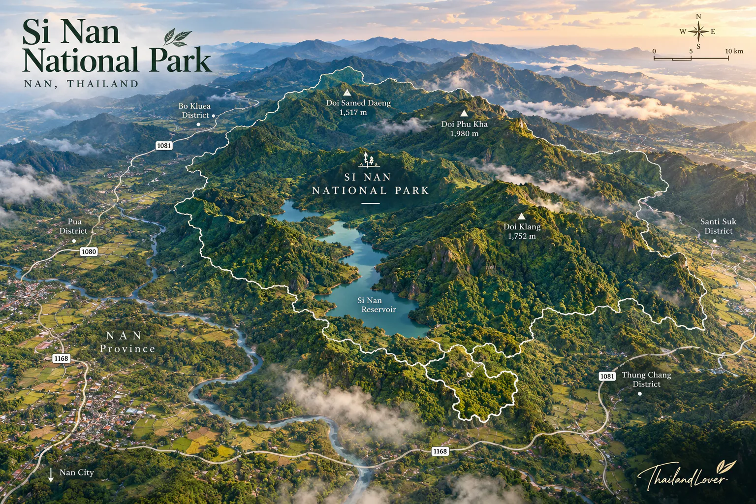
Location
Find Si Nan National Park
Na Muen, Na Noi & Wiang Sa, Nan · Doi Samer Dao and Pha Chu lie on the southern Nan mountain circuit