

National Park · Nan
Mae Charim National Park
อุทยานแห่งชาติแม่จริม
Where the River Is the Road
Nam Wa · Rafting · Mountain Forest
Follow the Nam Wa through mountain forests, rocky rapids and remote valleys in one of northern Thailand’s most adventurous national parks.
Mountain Forests, the Nam Wa River & the Wild Side of Nan
Far from the polished image of Nan’s old town, temples and quiet riverside cafés, another Nan exists beyond the valley. It is steeper. Wilder. And shaped by water.
This is Mae Charim National Park, a mountainous landscape in eastern Nan where the Luang Prabang and Phi Pan Nam mountain systems rise around some of the province’s most important headwaters.
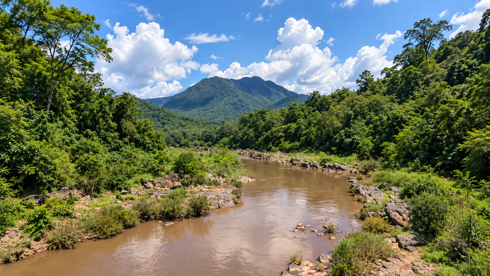
At the heart of the park is the Nam Wa River, a winding mountain river famous throughout northern Thailand for its rapids, forest valleys and white-water rafting routes. But Mae Charim is more than rafting. Its forests contain different ecological zones across changing elevations. Mountain roads climb toward remote villages and ridgelines. The Paeng River cuts through forest. Rock cliffs and caves appear along trekking routes. And near the park headquarters, the Nam Wa becomes a quieter river landscape surrounded by forest and camping areas.
For ThailandLover, Mae Charim is best understood as Nan beyond the postcard. A destination where the landscape is not simply something to look at. It is something to move through.
Where the mountains meet the river — and the river becomes the journey.
At a Glance
- 432 km²
- Published park area — 270,000 rai.
- 2007
- Established 6 July, as Thailand’s 106th national park.
- 1,652 m
- Doi Khun Lan, the highest point.
- ~30 km
- The lower Nam Wa, and the park’s main rafting landscape.
- 5 rapids
- Kaeng Pong → Luang → Sop Paeng → Sali → Ton Sai.
- Official Name
- Mae Charim National Park
- Thai Name
- อุทยานแห่งชาติแม่จริม
- Province
- Nan
- Districts
- Mae Charim & Wiang Sa
- Region
- Northern Thailand
- Published area
- 432 km² / 270,000 rai
- Established
- 6 July 2007 · National Park No. 106
- Mountain systems
- Luang Prabang Range & Phi Pan Nam Range
- Highest point
- Doi Khun Lan · approximately 1,652 m
- Main river
- Nam Wa River
- Other watercourse
- Paeng River
- Signature experience
- Nam Wa white-water rafting
- Main adventure area
- Lower Nam Wa
- Major rapids
- Kaeng Pong · Kaeng Luang · Kaeng Sop Paeng · Kaeng Sali · Kaeng Ton Sai
- Major trekking
- Pha No · Paeng River · Ban Rom Klao
- Scenic route
- Highway 1259 toward Ban Rom Klao
- Main access
- Nan → Highway 1168 → Mae Charim → Highway 1243
- Park character
- Mountain forest, rivers, rapids, cliffs and remote rural landscapes
Where Is Mae Charim National Park?
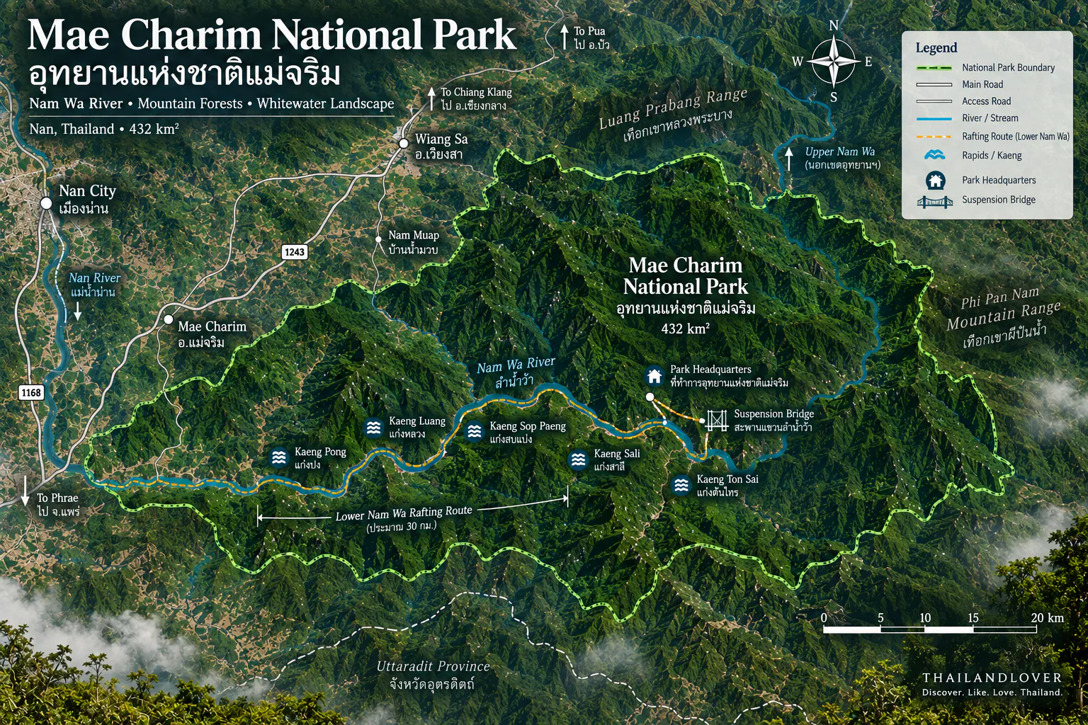
Mae Charim National Park lies in Nan Province, covering forest landscapes in parts of Mae Charim and Wiang Sa districts. The park is approximately 60 kilometres from Nan city, depending on the route and destination within the park.
Its location places it in a transition zone between Nan’s cultivated valley landscapes and the much more rugged mountains toward the east. The park’s western side connects conceptually with the Nan River basin, while the eastern mountain landscape rises toward the Luang Prabang mountain system along the Thailand–Laos frontier.
This geographical position is one of the reasons Mae Charim is so important as a watershed landscape.
The Geography
A mountain park shaped by water
More than 95% of the landscape is mountainous, according to local government planning information. The mountain ranges generally extend from north toward southwest, creating a complex terrain of ridges, valleys and steep slopes.
The major mountain systems associated with the park are the Luang Prabang Range and the Phi Pan Nam Range. The landscape rises from lower valleys toward high mountain ridges. Among the higher peaks:
- Doi Khun Lan
- Approximately 1,652 m — the highest point.
- Doi Daen Din
- Approximately 1,558 m.
- Doi Khun Poon
- Approximately 1,530 m.
- Doi Khun Koon
- Approximately 1,307 m.
These elevations are useful for understanding the scale of the terrain, but Mae Charim is not primarily a summit-climbing destination. Its character comes from the relationship between the mountains and the rivers running through them.
The Nam Wa River
ลำน้ำว้า · the river that defines Mae Charim
If one natural feature defines Mae Charim, it is the Nam Wa River. The river originates in the mountain landscape of northern Nan before flowing through Bo Kluea and Mae Charim and eventually joining the Nan River in Wiang Sa.
Its course is notably winding. The river passes through steep mountain valleys, forest, rocky cliffs, islands and exposed rocks, rapids, waterfalls and cascades, and quieter pools. It is particularly famous because of the extraordinary number and variety of rapids along its course. The Department of National Parks describes the Nam Wa as having hundreds of rapids along its longer upper and middle sections. That is what gives the river its reputation as one of Thailand’s major white-water destinations.
The Three Faces of the Nam Wa
The Nam Wa is often understood as three broad sections. They are not interchangeable. Water level, access and commitment change as the river descends.
- Upper Nam Wa
- The mountainous headwaters around Bo Kluea. Remote, technically demanding, and serious white-water. Rapids can reach approximately Class 3–5, depending on the section and conditions.
- Middle Nam Wa
- Downstream through the mountain landscape toward Mae Charim. One of the strongest white-water rafting experiences in Nan, still surrounded by forest, steep terrain and numerous rapids. The full middle route is much longer, and is normally a multi-day expedition rather than a casual tourist activity.
- Lower Nam Wa
- The section most closely associated with Mae Charim National Park. Considerably more accessible. The Department of National Parks describes it as approximately 30 kilometres, with the main park rafting route beginning around the national park headquarters. More approachable — not risk-free. Water conditions can still change significantly.
Five Rapids on the Lower Nam Wa
The lower section contains five named principal rapids. Together they give the river its rhythm: calm water, current, rocks, a rapid, a pool, forest, then another rapid. The lower Nam Wa is not a continuous white-water descent. It is a changing river landscape. That variation is part of its appeal.
- 1 · Kaeng Pong · แก่งปง
- One of the first named rapids on the lower route. Forest, exposed river rock, flowing water and mountain slopes. Best experienced as one chapter in the larger journey, not as a destination on its own.
- 2 · Kaeng Luang · แก่งหลวง
- One of the most prominent landmarks on the lower Nam Wa, closely connected with the park headquarters and camping. Rocky channels and strong flowing water, framed by forest. An important point on the combined route Ban Rom Klao → Paeng River → Kaeng Luang → Nam Wa. Even without rafting, this is one of the strongest places to understand the relationship between the park and the river.
- 3 · Kaeng Sop Paeng · แก่งสบแปง
- Farther along the lower sequence. The name reflects the meeting of the Paeng River and the Nam Wa. Not simply another rapid — a point where different waterways meet inside the larger watershed.
- 4 · Kaeng Sali · แก่งสาลี
- Another principal rapid, and part of the rhythm of the journey. The interest is the change of pace, not a single drop.
- 5 · Kaeng Ton Sai · แก่งต้นไทร
- One of the final named major rapids in the lower sequence. Together with Kaeng Luang and Kaeng Sali, it forms part of the best-known lower-river rafting experience in Mae Charim.
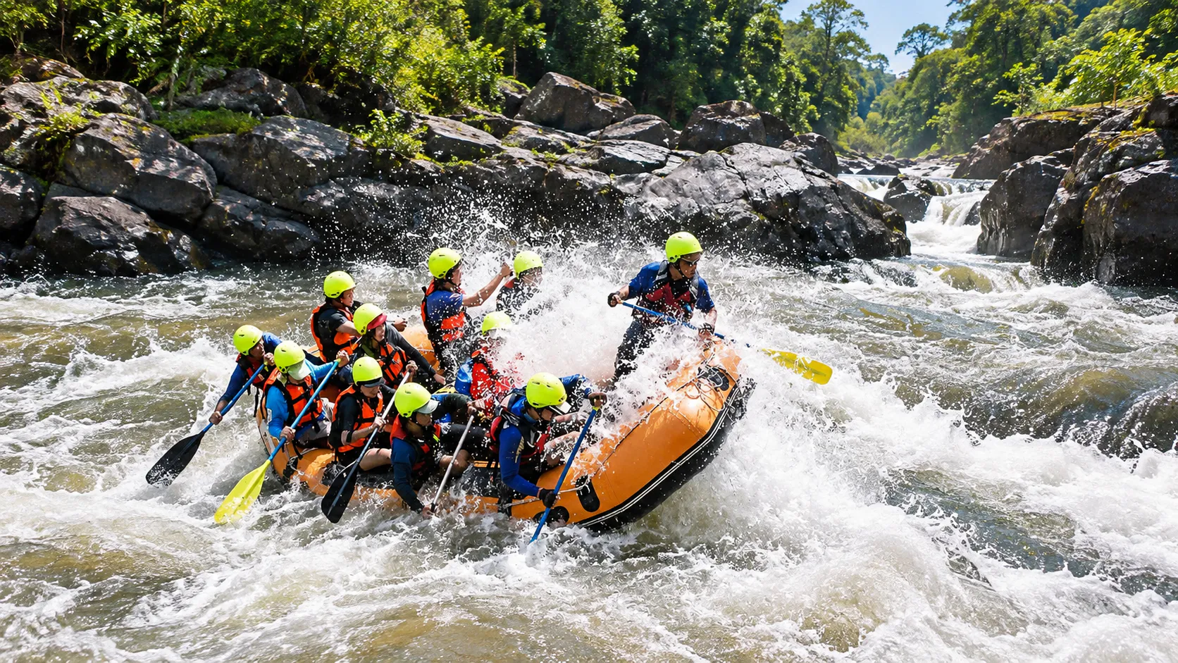
White-Water Rafting
Mae Charim’s signature experience
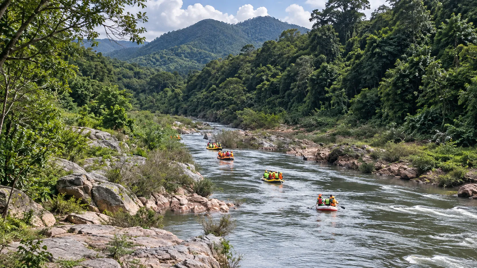
Rafting is the activity most strongly associated with Mae Charim. The principal inflatable-rubber-boat route traditionally begins around Ban Nam Pu in the Nam Phang / Nam Pang area and continues downstream toward Ban Hat Rai in Wiang Sa. The full route is approximately 19.2 kilometres. When starting from the area in front of the national park office, the rafting section is approximately 15 kilometres.
The lower Nam Wa is substantially more approachable than the upper and middle sections. However, more approachable does not mean risk-free. White-water rafting remains an activity requiring proper equipment, experienced guides, suitable weather, appropriate water levels, and compliance with park instructions.
The Nam Wa is not simply a series of rapids. The river passes through an almost cinematic sequence of landscapes. Forest closes around the boat. The river opens around a rocky bend. A rapid appears ahead. The current slows, and the mountains return.
Forest → a rocky bend → a rapid → calm water → the mountains again.
Bamboo Rafting
Mae Charim also has a slower form of river experience. The traditional bamboo rafting route begins around Ban Nam Wa and continues toward Ban Nam Pu. The route is approximately 4 kilometres and takes around 4 hours, according to tourism information.
This is fundamentally different from white-water rafting. It is slower, quieter, and more observational. Instead of focusing on rapids and adrenaline, the experience is about forest, river sounds, village landscapes, water and slower movement.
For ThailandLover, this is an excellent alternative for travellers who want to experience the Nam Wa but do not want a high-energy adventure.
Pha No
ผาหมอ · Pha No / Pha Nor · cliff, forest & rock paintings
Pha No is one of the park’s more adventurous trekking destinations. The route begins around Ban Nam Pu, crosses the Nam Wa and climbs through forest toward the rocky mountain landscape. The terrain includes deciduous dipterocarp forest, mixed deciduous forest, steep mountain slopes, rocky terrain and limestone formations.
One of the distinctive cultural features is the presence of rock paintings. The route combines trekking, geology, cultural traces and river adventure, which makes it one of the park’s more distinctive experiences.
The paintings are an important reminder that Mae Charim is not simply a wilderness landscape. People have interacted with this mountain environment long before modern tourism. They are found within a rugged rock landscape, not in a developed archaeological complex. Treat the site as fragile cultural heritage. Do not touch the paintings, scratch the rock, add markings, apply chalk, remove fragments, or climb directly over painted surfaces. The correct way to experience rock art is to observe it without leaving a trace.
Paeng River
ลำน้ำแปง
The Paeng River is one of the lesser-known but important components of Mae Charim’s adventure landscape. A trekking route follows the river between Ban Rom Klao and the Huai Sai area, eventually connecting toward the Nam Wa at Kaeng Luang. The route is approximately 9 kilometres and takes around 4 hours under the traditional itinerary.
The trail passes through several forest environments. This makes it particularly interesting for travellers who want to experience Mae Charim without rafting.
Ban Rom Klao & Highway 1259
The scenic mountain road
Ban Rom Klao is associated with one of Mae Charim’s most interesting scenic routes. The road toward the village follows Highway 1259, climbing into the mountain landscape. This is not simply a transport road. It becomes part of the experience: mountain views, forest, rural landscapes, elevated viewpoints, early-morning mist and sunrise opportunities. During the cooler season, the area can produce atmospheric views over the surrounding mountains.
Highway 1259 connects the Nam Phang / Ban Nam Pang area with Ban Rom Klao. For ThailandLover, this is one of the most interesting roads to highlight around Mae Charim. The road gradually moves away from the lowland landscape and into mountain terrain. It suits scenic driving, motorcycling, mountain biking, photography and sunrise trips.
During the cool season, the mountain road toward Ban Rom Klao can become a scenic sunrise route. Elevation, forest, cooler air, valleys and agricultural landscapes can produce morning mist and cloud layers. This is not a guaranteed “sea of mist” every morning. Weather determines the experience.
A mountain sunrise route with seasonal potential for mist and valley views.
The Forests of Mae Charim
Mae Charim contains several major forest types associated with changes in elevation and moisture. The same mountain slope can look completely different depending on the season.
- Hill evergreen forest
- Higher and cooler elevations. Relatively green and humid compared with the more seasonal forests below.
- Dry dipterocarp forest
- A more open seasonal forest adapted to the pronounced dry season. During the dry months, deciduous trees can lose their leaves, changing the colour and texture of the landscape.
- Mixed deciduous forest
- A transitional forest of mixed deciduous species. Particularly interesting visually in the change between seasons.
- Wet season
- Deep green forests, high stream flow and powerful rivers.
- Cool season
- Clearer mountain air, comfortable trekking, and potential morning mist.
- Dry season
- Deciduous forests change colour and shed leaves. Along the lower Nam Wa, the Department of National Parks notes yellow, orange and red tones.
Wildlife, Birds & Insects
Mae Charim’s extensive forest provides habitat for a range of wildlife. Because the park forms part of a larger forest landscape, observation is possible. ThailandLover does not recommend presenting a long list of species as if visitors are guaranteed to encounter them.
Mae Charim is a wildlife habitat first, and a wildlife-viewing destination second.
Potential observations can include birds, butterflies, insects, squirrels, forest mammals, reptiles and amphibians. The river and forest interface is particularly interesting for naturalists. Never approach or feed animals.
Birdwatching is an underrated reason to visit. Hill forest, deciduous forest, river corridors, mountain slopes and agricultural edges create multiple habitats. Early morning is the best period. Bring binoculars, a telephoto lens, a field guide and patience. Do not expect the forest to perform on command.
The forest can be especially rewarding for smaller forms of wildlife. The Department of National Parks has highlighted rare species such as the Actias maenas giant moth. A quiet walk beside the Nam Wa can reveal an entirely different world: butterflies, moths, dragonflies, beetles, amphibians and birds. Biodiversity here is not only large mammals.
A Watershed, and a Mountain Frontier
Mae Charim is fundamentally a watershed landscape. The mountains collect rainfall. The forest slows and filters the movement of water. Streams form. The Paeng River flows. The Nam Wa gathers water from the mountain landscape. Eventually, the water reaches the Nan River system. Protecting the forest here has consequences far beyond the park boundary. The landscape is not just “green space.” It is infrastructure provided by nature.
The Luang Prabang mountain range forms part of the broader mountainous landscape along the Thailand–Laos frontier. The mountains are not merely a backdrop. They influence climate, elevation, forest type, watersheds, river systems and settlement patterns. This gives Mae Charim a distinctly borderland geography — a landscape where the mountains define the relationship between two countries.
Why Mae Charim Feels Different
Nan has several famous national parks. Each has a different personality. Choose the one that matches the journey you actually want.
- Doi Phu Kha
- High mountain landscapes, rare flora and iconic viewpoints.
- Khun Nan
- Remote mountain forest, and the upper Nam Wa.
- Si Nan
- Wide valley views and dramatic viewpoints.
- Mae Charim
- River adventure, forest valleys and white-water landscapes. The park to choose when the journey itself is part of the destination.
Best Things to Do
- 1 · Raft the lower Nam Wa
- The signature experience. Best for active travellers.
- 2 · Visit Kaeng Luang
- One of the strongest places to understand the relationship between the park and the river.
- 3 · Explore the Paeng River
- A slower forest experience away from the main rafting route.
- 4 · Drive Highway 1259
- One of the best scenic mountain-road experiences around Mae Charim.
- 5 · Trek toward Pha No
- For experienced hikers interested in rock landscapes and cultural traces. Check seasonal closure first.
- 6 · Camp beside the river
- The headquarters area is a natural setting for camping and staying overnight.
- 7 · Watch the morning mist
- Drive toward the mountain villages early enough to catch changing light over the valleys.
- 8 · Look for birds & insects
- Slow down. This park rewards observation.
Best Season
- October – January
- Best overall. Comfortable temperatures, trekking, rafting, mountain scenery, camping and photography. The cooler season is particularly attractive for outdoor activities.
- September – January
- A strong rafting window. The Department of National Parks has historically identified September–January as suitable for the more demanding Nam Wa sections, while other official tourism information gives different seasonal windows depending on the section. Do not treat “Nam Wa rafting season” as one universal date. Upper, middle and lower sections behave differently. Always confirm the operating section and water conditions with the park or rafting operator.
- June – September
- Green season. The forest becomes intensely green, and streams and rivers rise. Heavy rain can also create strong currents, landslides, slippery trails, road damage and flash-flood risk. Beautiful, and it requires flexibility.
- March – May
- Hot and dry. Deciduous forests begin to change dramatically — some slopes take on yellow, orange and reddish tones. Outdoor activity can be uncomfortable in the hottest part of the day, and the period can be affected by smoke and wildfire conditions in northern Thailand.
For the lower Nam Wa, cooler months with suitable water levels are generally the strongest choice. For the upper and middle Nam Wa, this is specialist white-water territory. Water level changes the difficulty dramatically. The same rapid can behave differently from one month to another.
Choose the rafting date based on current river conditions, not simply the calendar.
How to Get There
- From Nan city
- The traditional route is Nan → Highway 1168 → Mae Charim → Highway 1243 → Ban Huai Sai Mun / the park area. The Department of National Parks describes the route from Nan as approximately 38 kilometres to Mae Charim, followed by the onward route toward the park. Depending on the destination inside the park, total travel distance is longer — about 60 kilometres is a useful planning figure.
- From Mae Charim district
- Follow the local route toward Ban Nam Phang / Ban Nam Pai and the park. The park headquarters has historically been associated with the Kaeng Luang area along the Nam Wa.
- From Phrae
- A route through Wiang Sa can connect to the southern side of the park. Useful when combining Mae Charim with southern Nan and Phrae.
- By private car
- The best option. Mae Charim is geographically spread out. The visitor experience is not concentrated at one entrance gate. A car lets you combine river, mountain road, village, trail and camping.
- Public transport
- Possible, but significantly less convenient. For a serious nature itinerary, arrange local transport, park transport, a rafting-operator transfer, or a private vehicle in advance.
Where to Stay, and How Long
Inside the national park there is visitor accommodation, camping areas, bathrooms and visitor facilities. Department of National Parks accommodation records list several park houses in the headquarters zone, including units associated with Nam Wa, Kaeng Luang, Chaba Pa and Pha No. Availability and prices should be confirmed before booking. Current visitor information also promotes camping, trekking and trail running.
Camping is one of the strongest ways to experience Mae Charim. Especially around the river, the sound of flowing water becomes part of the night.
- Half day
- Only for passing through, viewing the river, or a short stop. Not enough for the full Mae Charim experience.
- One day
- A scenic drive, the river, one activity and a short trek.
- 2 days / 1 night
- ThailandLover’s minimum. Day 1: Nan → Mae Charim → Highway 1259 → Ban Rom Klao → forest and mountain landscape → camping. Day 2: the Nam Wa, rafting or a quieter river experience, then an afternoon departure.
- 3 days / 2 nights
- Best if you want rafting, trekking, camping, photography and slow travel. Enough time to experience the park rather than simply passing through.
A ThailandLover Adventure
The river & mountain journey · 3 days / 2 nights
This is much more representative of Mae Charim than attempting to collect every attraction in one day. Adjust it to current trail access, water levels and park instructions.
- Day 1
- Into the mountains. Nan → Mae Charim → Ban Nam Phang → Highway 1259 → Ban Rom Klao. Spend the afternoon in the mountain landscape. Stay overnight.
- Day 2
- Forest to river. A morning trek along the Paeng River, continuing toward Kaeng Luang. Afternoon: Nam Wa rafting. Return to the park and camp beside the river.
- Day 3
- A slow morning. Wake early. Listen to the river. Birdwatch. Photograph the forest. Then return toward Nan.
Safety
This is an adventure park, not a theme park.
Mae Charim’s beauty comes with real terrain.
- White water — use approved flotation equipment, a helmet, experienced guides and appropriate boats. Never attempt a difficult rapid independently.
- Rain — heavy rain can change the Nam Wa quickly. Water levels can rise rapidly. Do not enter the river based only on how it looks from shore.
- Trekking — remote trails need proper footwear, sufficient water, navigation, local or park guidance, and weather awareness. Some routes are steep and physically demanding.
- Rock paintings — do not touch or climb on painted surfaces.
- Wildlife — never approach or feed animals.
Responsible Travel
Mae Charim’s greatest asset is its water. Protect the water.
- No rubbish in the river, and no detergent in streams
- No single-use waste left behind, and no damage to riverbank vegetation
- No collecting rocks or plants
- No touching rock art, and no feeding wildlife
- No loud music in forest areas
When rafting, follow the guide’s instructions not only for safety but also for river conservation.
What to Bring
- Day trip
- Water, sun protection, comfortable shoes, insect repellent, rain protection, a dry bag, phone protection and a small first-aid kit.
- Rafting
- Quick-dry clothes, secure footwear, a waterproof bag, a change of clothes and sunscreen.
- Trekking
- Trekking shoes, sufficient water, snacks, a headlamp, a rain shell, insect repellent and navigation equipment.
- Camping
- A warm layer, sleeping equipment, a headlamp and waterproof storage.
Who Should Visit?
- Adventure travellers and rafting enthusiasts
- Hikers, campers and photographers
- Birdwatchers and road-trip travellers
- Nature lovers looking for a less conventional side of Nan
- People who enjoy active travel
- Adventure travellers
- The Nam Wa is the obvious reason to come.
- Road trippers
- Highway 1259 adds a scenic mountain-road dimension.
- Slow travellers
- The park rewards staying overnight.
- Photographers
- River, forest, mountain and mist create a strong visual combination.
- Outdoor families
- Some lower-river experiences can be suitable, but rafting difficulty must be selected carefully.
Mae Charim may not be ideal if you want easy roadside sightseeing, luxury infrastructure, cafés everywhere, highly developed attractions, short walks only, guaranteed viewpoints, or no physical activity.
Mae Charim asks you to participate.
ThailandLover Rating
An editorial assessment of the destination experience, not an official government rating. Mae Charim scores exceptionally highly for river adventure and active nature travel. Its greatest strength is not the number of conventional attractions. It is the quality of the journey through the landscape.
- Landscape
- Mountains, valleys and a river that organises the view.
- River experience
- The Nam Wa is the reason to come.
- Adventure
- A park you move through, not a viewpoint you tick off.
- Rafting
- The signature, and still dependent on the water.
- Forest
- Several forest types across the elevation.
- Hiking
- Pha No and the Paeng River reward commitment.
- Photography
- River, forest, mountain and seasonal mist.
- Wildlife
- Habitat first. Sightings are not a promise.
- Scenic roads
- Highway 1259 is part of the experience.
- Camping
- The river becomes the night.
- Accessibility
- Spread out, and best with your own vehicle.
- Facilities
- Park houses and camping — confirm first.
- Overall
- Don’t just look at the river. Follow it.
Essential Information
- Destination
- Mae Charim National Park · อุทยานแห่งชาติแม่จริม
- Province
- Nan · Mae Charim & Wiang Sa districts
- Area
- 432 km² / 270,000 rai
- Established
- 6 July 2007 · National Park No. 106
- Highest point
- Doi Khun Lan · approximately 1,652 m
- Main river
- Nam Wa · lower section approximately 30 km
- Secondary river
- Paeng River
- Signature activity
- White-water rafting
- Main rapids
- Kaeng Pong · Kaeng Luang · Kaeng Sop Paeng · Kaeng Sali · Kaeng Ton Sai
- Major trek
- Pha No
- Scenic road
- Highway 1259
- Main access
- Highway 1168 + Highway 1243
- Accommodation
- Park houses and camping
- Best overall season
- October–January
- Best for green forest
- Rainy season, subject to access
- Best for rafting
- Depends on current river conditions
Frequently Asked Questions
- What is Mae Charim National Park?
- A mountainous park in eastern Nan, where the Luang Prabang and Phi Pan Nam ranges rise around the Nam Wa. It is Nan beyond the postcard: forest valleys, rapids, cliffs, scenic roads and riverside camping — a landscape you move through, not a viewpoint you simply look at.
- Where is it?
- Mae Charim and Wiang Sa districts, Nan, about 60 kilometres from Nan city depending on the route. The traditional approach is Highway 1168 to Mae Charim, then Highway 1243 toward Ban Huai Sai Mun and the park.
- How large is the park, and when was it established?
- 432 km², or 270,000 rai. Established 6 July 2007 as Thailand’s 106th national park. The highest point is Doi Khun Lan, approximately 1,652 metres.
- Which rapids are on the lower Nam Wa?
- The lower section is approximately 30 kilometres. The five named principal rapids are Kaeng Pong, Kaeng Luang, Kaeng Sop Paeng, Kaeng Sali and Kaeng Ton Sai. Rapids around Kaeng Luang, Kaeng Ton Sai and Kaeng Sali are generally described as about Class 2–4, depending on water level.
- When should I visit, and when should I raft?
- October to January is the strongest overall window. September to January has historically suited more demanding sections, but upper, middle and lower Nam Wa behave differently. Choose the date from current river conditions, and confirm the operating section with the park or operator.
- How do I get there?
- From Nan, Highway 1168 covers about 38 kilometres to Mae Charim, then Highway 1243 continues toward the park. A route through Wiang Sa connects from Phrae. A private car is the practical choice. Public transport is possible, and much less convenient.
- How long do I need?
- A half day is only a short river stop. One day can cover a drive, the river and one activity. ThailandLover recommends a minimum of two days and one night. Three days and two nights is better for rafting, trekking, camping and photography.
More of Nan’s Mountain Parks
- Doi Phu Kha National Park
- High mountain landscapes, rare flora and the viewpoints Nan is already famous for.
- Khun Nan National Park
- Remote mountain forest, and the upper Nam Wa — a different commitment on the same river.
- Si Nan National Park
- Wide valley views and dramatic viewpoints, if you want the landscape opened outward.
- Lam Nam Nan National Park
- Farther down the Nan watershed, where forested mountains meet Sirikit Reservoir.
Location
Find Mae Charim National Park
Ban Huai Sai Mun, Nam Pai, Mae Charim, Nan 55170 · about 60 km east of Nan city