


National Park · Sakon Nakhon · Kalasin
Phu Phan National Park
อุทยานแห่งชาติภูพาน
Sandstone mountains, forest waterfalls, winding roads, royal history and the landscapes of the Phu Phan Range
Sakon Nakhon & Kalasin · Northeastern Thailand — Isan
Thailand’s 7th national park — a layered Isan landscape of forest, water, scenic roads and stories that stretch from Khmer stone to wartime caves.
A Landscape to Explore Slowly
Phu Phan National Park is one of the most important protected landscapes in northeastern Thailand.
Stretching across parts of Sakon Nakhon and Kalasin provinces, the park protects approximately 664.70 square kilometres of sandstone mountains, forests, cliffs, streams and headwaters.
Established in 1972 as Thailand’s 7th national park, Phu Phan is part of the larger Phu Phan mountain range that runs across northeastern Thailand.
For travelers, the park offers a combination that is distinctly Isan: forest and waterfalls, scenic mountain roads, historic sites, viewpoints, royal connections and traces of the region’s more recent political history.
It is a destination to explore slowly rather than simply tick off one attraction.
At a Glance
- Official Name
- Phu Phan National Park
- Thai Name
- อุทยานแห่งชาติภูพาน
- Region
- Northeastern Thailand — Isan
- Provinces
- Sakon Nakhon & Kalasin
- Area
- Approximately 664.70 km² / 415,439 rai
- Highest Point
- Phu Khiao — approximately 567 m
- Mountain Range
- Phu Phan Range
- Landscape
- Sandstone mountains, forest, cliffs and streams
- National Park No.
- Thailand’s 7th
- Established
- 1972
Why Visit Phu Phan?
Phu Phan is not defined by a single spectacular landmark. Its appeal comes from the relationship between mountains, forest, water and history.
The park occupies part of the Phu Phan mountain range, with elevations generally ranging from approximately 200 to 567 metres above sea level. Its sandstone geology has created cliffs, rocky areas and elevated plateaus, while the forested mountains form an important watershed for several rivers and streams in northeastern Thailand.
For visitors, this translates into a surprisingly varied itinerary:
- Waterfalls in the forest
- Cliff-top viewpoints
- Scenic mountain roads
- Historic caves
- Royal residences
- Quiet forest landscapes
The Phu Phan Mountains
Phu Phan National Park lies within the Phu Phan mountain range, a major geographical feature of northeastern Thailand.
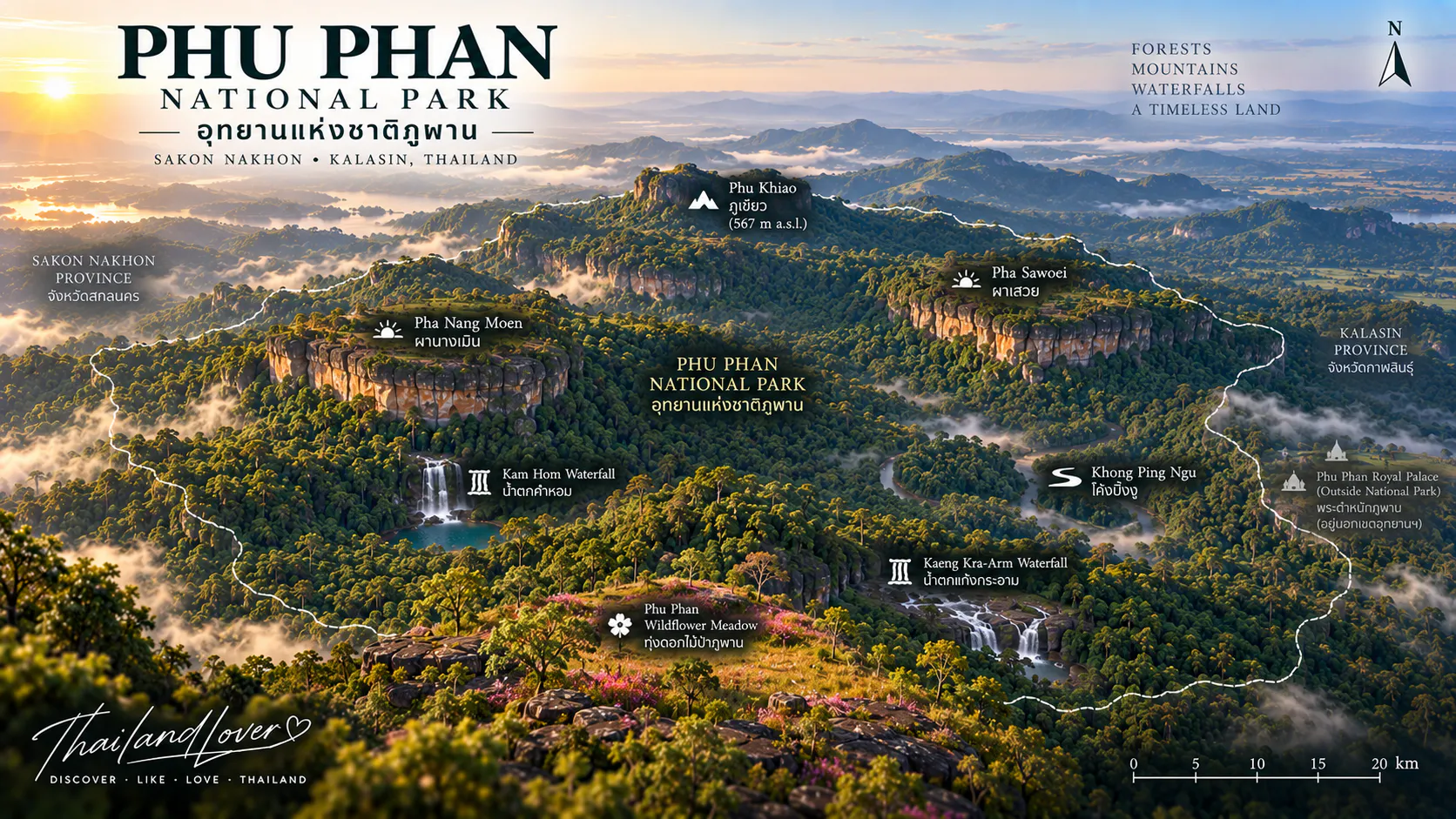
The park’s geology is dominated by sandstone. The terrain rises from around 200 metres to 567 metres above sea level, with Phu Khiao in Kalasin Province forming the highest point within the park.
The mountains are more than scenic landmarks. They are also important watersheds. Streams originating in the park feed several waterways, eventually contributing to the Nam Mun, Nam Pung, Lam Pao and other river systems across the region.
An ecological landscape as well as a recreational destination.
Forests & Biodiversity
Phu Phan’s forests can broadly be divided into three major types.
- Dry Dipterocarp Forest
- Found particularly around the lower and middle elevations. Typical trees include Dipterocarpus, Shorea, Hopea, Pterocarpus and Lagerstroemia. During the dry season these forests develop a distinctly seasonal appearance, with dry leaves and open woodland creating a very different atmosphere from evergreen forests.
- Mixed Deciduous Forest
- Occurs mainly in the southern parts of the park. It contains a diverse mixture of deciduous trees, bamboo and other understory plants.
- Dry Evergreen Forest
- Higher and more humid areas support patches of dry evergreen forest. These areas remain greener through the dry season and provide important habitat for wildlife.
Wildlife
Phu Phan National Park supports a wide variety of wildlife. Species reported from the park include wild elephant, sambar deer, muntjac, wild boar, northern pig-tailed macaque, bears, civets, otters, small mammals, numerous bird species, reptiles and freshwater fish.
Wildlife encounters are never guaranteed. The park’s forest is primarily a habitat rather than a wildlife viewing facility, so visitors should observe animals quietly and from a safe distance.
Pha Nang Moen
ผานางเมิน · A Classic Phu Phan Viewpoint
Pha Nang Moen is one of the best-known viewpoints within Phu Phan National Park. The sandstone cliff stretches for approximately 50 metres, rising around 300 metres above sea level.
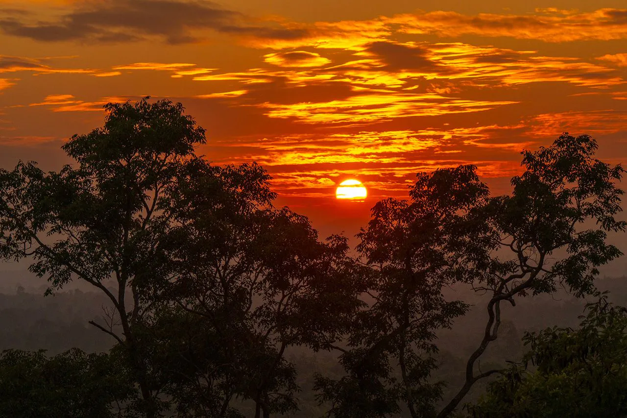
The viewpoint looks across the surrounding forest and mountain landscape. It is particularly known as a place to watch the sunset. As the sun drops behind the landscape, the exposed sandstone and forest become warmer in colour, making late afternoon one of the most atmospheric times to visit.
For photographers, the combination of open sky, layered hills and sandstone makes this one of the park’s signature landscape locations.
Forest Waterfalls
Phu Phan’s waterfalls are part of a living seasonal landscape rather than permanent year-round attractions. Water flow depends heavily on rainfall.
- Kam Hom Waterfall
- One of the best-known natural attractions in the park. The waterfall is surrounded by forest and rocky terrain, creating a cool and shaded environment during periods of good water flow. It is seasonal. The rainy season is the most suitable period if seeing flowing water is a priority; during drier periods the waterfall can become much smaller.
- Preecha Suksan Waterfall
- Another waterfall along the park’s scenic route. Rather than being a massive drop, it is characterized by water flowing gently across a rocky landscape. The stream and surrounding rock create a more intimate forest setting. Like Kam Hom, it is primarily a rainy-season attraction.
- Kaeng Kra-Aam Waterfall
- Another natural attraction associated with the park, included among the main sites highlighted by the Tourism Authority of Thailand. Water flow is seasonal, so conditions can vary substantially depending on recent rainfall.
Khok Phu Phan & Scenic Forest Roads
One of the pleasures of visiting Phu Phan is simply driving through the mountain landscape. The roads crossing the park connect several attractions and viewpoints while passing through forest and sandstone terrain.
The scenery changes with the season: green and lush during the rainy season, cool and relatively dry during the winter, warmer and more open during the hot season. This is particularly appealing to travelers who enjoy road trips rather than visiting attractions one by one.
The Snake-Curve Road
โค้งพิงงู · Khong Ping Ngu
One of the most recognizable roads associated with the Phu Phan area is Khong Ping Ngu, often translated descriptively as the Snake-Curve Road.
The road winds through the mountainous landscape in a series of pronounced bends. Its curves have made it one of the area’s best-known scenic roads and a popular photography stop.
The road is more than a viewpoint, however. It is part of the experience of traveling through the Phu Phan mountains. Drive carefully, particularly when stopping for photographs. Do not stop in active traffic lanes or on blind corners.
Phu Phan Royal Residence
พระตำหนักภูพานราชนิเวศน์ · Phu Phan Ratchaniwet
The Phu Phan Royal Residence is located within the wider Phu Phan landscape. It was established as a royal residence associated with visits by King Bhumibol Adulyadej and the Thai royal family during their work and visits in northeastern Thailand.
The architecture and landscaped grounds differ considerably from the surrounding forest. When the royal family is not in residence and access is permitted, visitors may be able to enter designated areas.
Access conditions should always be checked before visiting because the site remains a royal residence and visitor access is subject to official arrangements. The residence adds an important historical dimension to a trip through Phu Phan.
Seri Thai Cave
ถ้ำเสรีไทย · A Place of Modern History
Phu Phan’s history is not limited to geology and forests. Seri Thai Cave is associated with the Free Thai Movement (Seri Thai) during the Second World War.
The cave area was used as a location for storing weapons and supplies connected with the movement’s resistance activities. The Free Thai Movement was a Thai resistance network that opposed the Japanese occupation and collaborated with the Allies during World War II.
Today, the cave provides a tangible connection to this period of Thai history. The attraction is particularly interesting because it demonstrates how the difficult terrain of the Phu Phan mountains once provided strategic shelter.
Phu Phek
พระธาตุภูเพ็ก · Ancient Khmer Architecture on the Mountain
One of the most remarkable cultural landmarks associated with the Phu Phan landscape is Phra That Phu Phek. The sandstone structure stands on Phu Phek Mountain.
It is an ancient Khmer-style sanctuary constructed primarily from sandstone and is generally associated with the Bayon period. The structure was apparently left unfinished. Visitors reach the site by climbing approximately 491 steps. The climb is part of the experience. At the top, the sanctuary is accompanied by broad views across the surrounding landscape.
Although Phra That Phu Phek is closely associated with the Phu Phan area, travelers should distinguish it from the core national park visitor facilities when planning their route.
Natural Stone Bridge
A Geological Curiosity
Within the park’s wider protected landscape are natural sandstone formations created through long-term erosion. One notable formation is a natural stone bridge, shaped like an archway.
Weathering and erosion have gradually removed weaker portions of the sandstone, leaving stronger sections behind. It is a useful reminder that many of Phu Phan’s attractions are not constructed landmarks. They are landscapes shaped over geological time.
Seasonal Wildflowers
Phu Phan’s rocky areas can become home to seasonal wildflowers during the wetter months and the transition into the cool season. Small flowering plants emerge among the grasses and exposed sandstone.
The experience is subtle rather than spectacular. The flowers are often low to the ground and easy to overlook. If photographing them, stay on designated paths and avoid stepping onto flowering areas. The best flowering period can vary from year to year according to rainfall.
Climate & Seasons
- Cool season · November–February
- Generally the most comfortable period for hiking and sightseeing. Temperatures are cooler, especially in the morning and at higher elevations. The forest is relatively dry, while the weather is often suitable for outdoor activities.
- Hot season · March–May
- Temperatures rise substantially. The sandstone landscape can become hot in direct sunlight. Morning and late afternoon are more comfortable than midday.
- Rainy season · June–October
- Rainfall increases and the forest becomes greener. This is the best period for seeing seasonal waterfalls with stronger water flow. Wet rocks and trails can become slippery. September typically receives particularly heavy rainfall.
Best Time to Visit
There is no single perfect season for every experience.
- For waterfalls
- Rainy season — June to October
- For comfortable hiking
- Cool season — November to February
- For green forest landscapes
- Rainy season
- For sunset photography
- Dry or cool season afternoons
- For road trips
- Cool season
If your priority is waterfalls, check recent rainfall before traveling rather than relying only on the calendar.
Things to Do
- Explore the waterfalls
- Visit Kam Hom and Preecha Suksan when seasonal water flow is active.
- Watch the sunset
- Pha Nang Moen is one of the park’s classic sunset viewpoints.
- Take the scenic road
- Drive carefully through Khong Ping Ngu and the surrounding mountain roads.
- Explore history
- Visit Seri Thai Cave and learn about the Free Thai Movement.
- Experience royal history
- Explore the designated visitor areas of Phu Phan Royal Residence when access is permitted.
- Visit Phu Phek
- Combine the ancient sanctuary with a wider cultural itinerary around Sakon Nakhon.
- Photograph the landscape
- Sandstone cliffs, forest roads, waterfalls and seasonal vegetation offer different photographic opportunities throughout the year.
Photography Guide
- Early morning
- The cooler light works well for forest and mountain landscapes. Mist may occasionally form after rainfall, although it should never be treated as guaranteed.
- Late afternoon
- Pha Nang Moen is particularly suitable for sunset photography.
- Waterfalls
- During the rainy season, slower shutter speeds can emphasize flowing water. Always use caution around wet rocks.
- Scenic roads
- Khong Ping Ngu works best with a composition that shows both the road and the surrounding mountain landscape. Do not position yourself in traffic lanes to obtain a photograph.
How to Get There
The main visitor area of Phu Phan National Park is in Sakon Nakhon Province, with road access connecting the park to Sakon Nakhon and Kalasin.
The most practical option for independent travelers is a private car or rental vehicle, particularly if you want to visit several attractions. From Sakon Nakhon city, the park is accessible by road toward the Phu Phan mountain area.
Because attractions are distributed across the wider landscape, allow additional time if you plan to combine waterfalls, viewpoints, historical sites and Phu Phek in one itinerary.
Where to Stay
The national park provides visitor accommodation and camping facilities around the main park area. Facilities include a visitor service centre and camping areas.
Availability can vary, so travelers planning to stay overnight should confirm current accommodation and camping conditions with the park before departure.
For travelers who prefer a larger selection of hotels and restaurants, Sakon Nakhon city is a practical base for exploring the area.
Travel Tips
- Bring water — several viewpoints and exposed sandstone areas can become hot
- Wear proper shoes — wet rocks and forest trails can be slippery during the rainy season
- Visit waterfalls after rain — seasonal waterfalls are strongly dependent on rainfall
- Start early — morning temperatures are generally more comfortable
- Allow driving time — the national park is large and attractions are spread across different areas
- Respect royal sites — access to the royal residence can be restricted when official activities take place
- Protect historic sites — do not touch, damage or remove anything from caves, archaeological sites or historic structures
- Respect wildlife — do not feed animals or attempt to approach them
- Check before you go — opening conditions, trails, accommodation, camping and individual attractions can change because of weather and park management
A Landscape Shaped by History
Phu Phan is unusual because its landscape has played different roles across different periods of Thai history.
The mountains first formed a natural environment of sandstone, forest and water. Later, the same terrain supported settlements and ancient routes. Centuries ago, the wider region became part of the cultural landscape influenced by the Khmer world. During the Second World War, the mountains provided shelter for the Free Thai resistance. In the modern era, the area became closely associated with royal development projects and the conservation of natural resources.
The landscape remained the same. The people and stories around it changed.
Essential Information
Phu Phan National Park
Sakon Nakhon & Kalasin, Thailand
- Area
- Approximately 664.70 km²
- Elevation
- Approximately 200–567 m
- Highest Point
- Phu Khiao — approximately 567 m
- Established
- 1972
- National Park
- Thailand’s 7th
Signature Experiences
- Pha Nang Moen
- A sandstone cliff and well-known sunset viewpoint.
- Kam Hom Waterfall
- A forest waterfall with seasonal flow.
- Preecha Suksan Waterfall
- A smaller rocky waterfall along the park route.
- Khong Ping Ngu
- A winding mountain road and scenic drive.
- Seri Thai Cave
- A historical site associated with the Free Thai Movement during World War II.
- Phu Phan Royal Residence
- A royal residence associated with visits to northeastern Thailand.
- Phra That Phu Phek
- An ancient sandstone Khmer-style sanctuary on Phu Phek Mountain, reached by approximately 491 steps.
Frequently Asked Questions
- Where is Phu Phan National Park?
- It stretches across parts of Sakon Nakhon and Kalasin in northeastern Thailand. The main visitor area is in Sakon Nakhon Province.
- What is Phu Phan famous for?
- Sandstone mountains, Pha Nang Moen sunsets, seasonal waterfalls, the Khong Ping Ngu snake-curve road, Seri Thai Cave and royal history.
- How large is the park?
- Approximately 664.70 km², or about 415,439 rai. Attractions are spread out, so plan driving time.
- When is the best time to visit?
- June–October for waterfalls; November–February for comfortable hiking and road trips. Sunset photography is often strongest in the dry or cool season.
- Are the waterfalls year-round?
- No. Kam Hom, Preecha Suksan and Kaeng Kra-Aam are largely rainy-season features.
- Can I visit the royal residence?
- Sometimes, when the royal family is not in residence and access is permitted. Always check official arrangements before you go.
- Is Phra That Phu Phek inside the park headquarters area?
- It is closely associated with the Phu Phan landscape, but travelers should treat it as a separate stop when planning the route.
- Is Phu Phan the same as Phu Pha Lek or Phu Pha Yon?
- No. They are separate national parks within the wider Phu Phan mountain system.
Related Destinations
- Phu Pha Yon National Park
- Ancient rock art, Huai Huad Reservoir and wildflower plateaus in the same sandstone country.
- Phu Pha Lek National Park
- A separate Phu Phan-range park of sandstone plateaus, wildflowers and night skies.
- Phu Pha Thoep National Park
- Compact Mukdahan sandstone, Hin Thoep formations and Mekong views.
- Phu Kao–Phu Phan Kham National Park
- Another Phu Phan-range landscape, with reservoir views and ancient rock sites near Khon Kaen.
Location
Find Phu Phan National Park
Sakon Nakhon · Kalasin · Northeastern Thailand