


National Park · Phu Phan Range · Isan
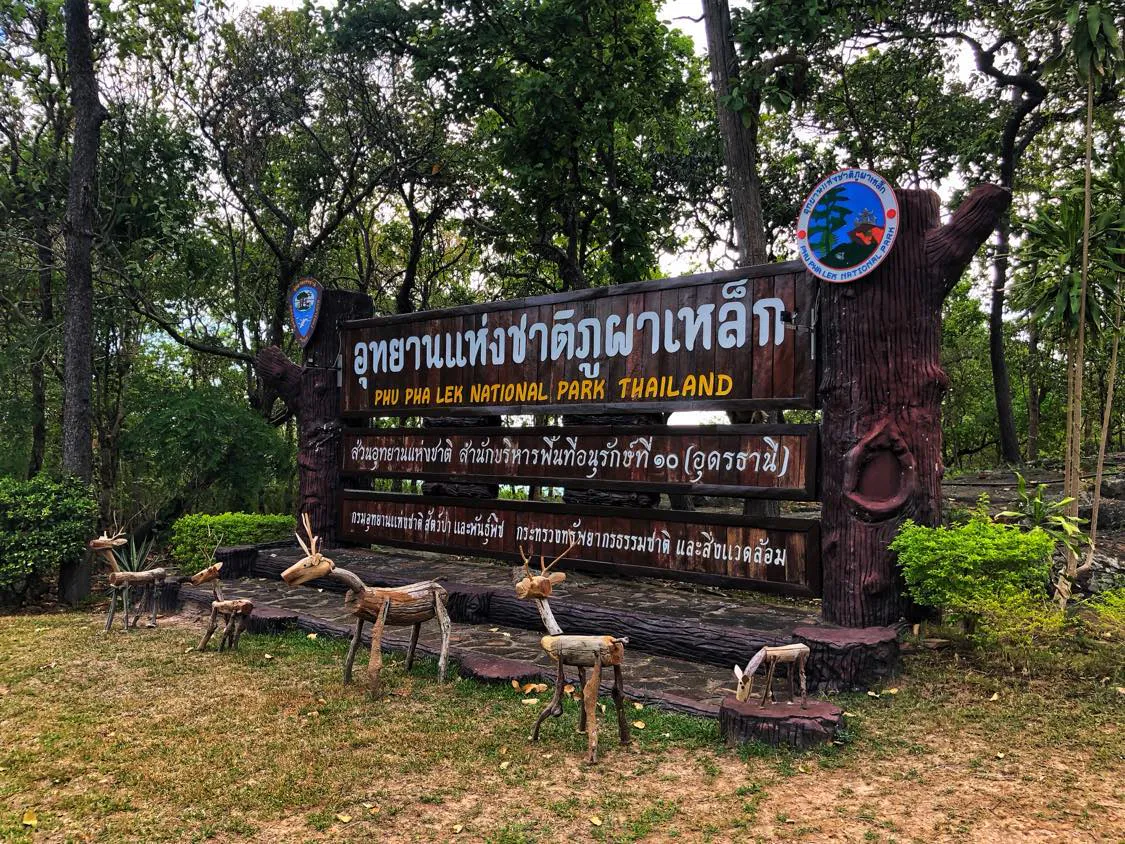
Phu Pha Lek National Park
อุทยานแห่งชาติภูผาเหล็ก
Ancient Rocks, Mountain Forests, Wildflowers & the Night Sky
Sakon Nakhon · Udon Thani · Kalasin · Northeastern Thailand
A vast mountain landscape where sandstone cliffs, prehistoric paintings, seasonal flowers, forests and stars tell stories across an extraordinary span of time.
A Mountain of Many Stories
Phu Pha Lek stretches across the Phu Phan mountain range, covering parts of three provinces and bringing together geology, archaeology, forest, water, wildlife and the night sky.
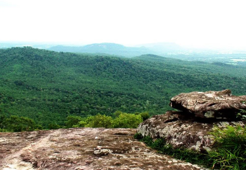
Dry forest grows across broad slopes. Sandstone cliffs rise above the countryside. Wildflowers appear on open rocky plateaus after the rains, while mountain streams flow toward important river systems.
Hidden among the rocks are prehistoric paintings, fossils and petrified wood — traces of worlds that existed long before recorded civilization. At night, open summit areas become natural windows onto the stars.
Phu Pha Lek is more than a viewpoint. It is a journey through deep time.
At a Glance
- Official Name
- Phu Pha Lek National Park
- Thai Name
- อุทยานแห่งชาติภูผาเหล็ก
- Region
- Northeastern Thailand · Isan
- Provinces
- Sakon Nakhon, Udon Thani and Kalasin
- National Park Number
- 118
- Area
- Approximately 261,875 rai / 419 km²
- Highest Point
- Phu Ang So · approximately 695 metres
- Mountain Range
- Phu Phan Range
- Headquarters
- Ban Tha Wat, Pathum Wapi, Song Dao, Sakon Nakhon
- Best For
- Viewpoints, archaeology, wildflowers, hiking, camping and stargazing
The park reaches Song Dao, Waritchaphum, Nikhom Nam Un and Kut Bak in Sakon Nakhon; Wang Sam Mo in Udon Thani; and Somdet and Kham Muang in Kalasin.
Why Visit Phu Pha Lek?
No single landmark defines this park. Its appeal comes from the variety of experiences within one protected mountain landscape.
- Stand above the layered Phu Phan mountains
- Walk across weathered sandstone plateaus
- See prehistoric paintings and ancient fossils
- Find seasonal wildflowers at Lan Usa Sawan
- Watch sunrise or sunset from high cliffs
- Camp beneath a wide, dark night sky
The Phu Phan Mountain Landscape
The park forms part of one of northeastern Thailand’s major upland systems. Terrain generally rises from about 200 to 600 metres, reaching approximately 695 metres at Phu Ang So.
Sandstone defines the mountains as cliffs, terraces, boulders, caves and natural ledges. Rain enters cracks, water wears through softer layers and plants take root around the rock. Over geological time, these forces have shaped a sculptural landscape of stone surfaces and ridges.
A Mountain of Water
The forested highlands are the source of important waterways, including the Songkhram River, Lam Nam Yam and Lam Nam Oom. Protecting the park therefore helps safeguard water resources far beyond its boundaries.
Forests & Rocky Highlands
- Dry Dipterocarp Forest
- Open woodland across drier slopes, transformed by leaf fall, sunlight and seasonal grasses during the dry months.
- Mixed Deciduous Forest
- Rosewood, Burmese padauk, Afzelia, ironwood and bamboo turn fresh green as the rains return.
- Dry Evergreen Forest
- Denser, moister corridors around streams and valleys support wild fruit trees, rattan, palms and wildlife.
- Rocky Highlands
- Open, wind-exposed areas around 400–550 metres support lichens, low vegetation and specialized flowering plants.
Wildflowers of Lan Usa Sawan
Lan Usa Sawan is an elevated plateau of approximately 1,550 rai, combining open forest, rock, shrubs and grassland. In season, flowers such as Doi sar, En-ao, Phu marigold, Ma wing, Khao kam grass, silver buttons and Dusita turn the plateau into a natural garden.
Song Dao Observatory & Stargazing
Song Dao Observatory is one of the park’s signatures. A road of about 5.5 kilometres from park headquarters reaches the upper area, followed by walks to individual attractions.
Broad horizons make clear nights rewarding for stars, constellations, meteor showers and Milky Way photography. Cloud cover and moonlight matter as much as the season, so check both the weather and moon phase before travelling.
Keep lights low and voices quiet. Darkness and silence are part of the experience.
Cliffs & Viewpoints
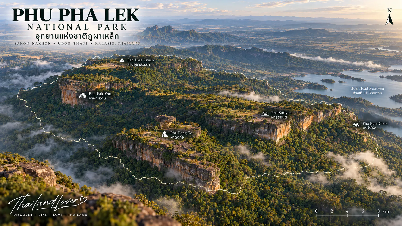
- Pha Suriyan
- A high cliff associated with sunrise, when low light reveals layers of ridge, forest and shadow.
- Pha Dong Ko
- Large rocks near the cliff edge frame sweeping views toward Phu Phak, Phu Mai, Phu Sak Lak and Wang Sam Mo.
- Pha Nam Chok
- A natural observation platform overlooking Huai Huad Reservoir and, in clear weather, landscapes toward Udon Thani and Khon Kaen.
Pha Phak Wan Prehistoric Paintings
Near Ban Phu Takham, about 18 kilometres from park headquarters, red pigment figures remain visible on a large rock surface. Local and provincial tourism sources place the paintings at approximately 3,600 years old.
One recognizable scene resembles people standing in a line with hands on one another’s shoulders — a rare connection between the modern mountain and prehistoric human life.
Fossils, Petrified Wood & Deep Time
Areas of the park are associated with fossilized animal remains and petrified wood, including a place known locally as the Dinosaur Cemetery. These traces record environments millions of years older than today’s mountains and communities.
Petrified wood retains the structure of ancient wood after minerals gradually replace its organic material. It may look familiar, but it is protected natural heritage and must never be collected.
Geological time → fossilized life → prehistoric people → modern forest → living communities.
Waterfalls & Caves
Seasonal water features include Kao Chan Waterfall, Mae Kham Dee, Kaeng Kula and the stepped Nine-Tier Waterfall. Flow is strongest in the rainy season and may reduce considerably in dry months.
Sandstone caves and shelters include Thong Cave and Nok Kok Cave. Enter only officially accessible areas and avoid disturbing bats or other cave wildlife.
Wildlife & Birdlife
The park supports barking deer, macaques, rabbits, squirrels, porcupines, mongooses, civets, reptiles and amphibians. Snakes recorded in the area include cobras, king cobras and green pit vipers; they usually avoid people, so observe from a distance and never handle wildlife.
Green pigeons, coucals, rollers, barbets, orioles, bulbuls and drongos are among the recorded birds. Early morning is best: listen first, because calls often reveal birds before movement does.
Climate & Best Time to Visit
- Cool season · November–February
- Comfortable for hiking, viewpoints and camping. Mountain nights can feel cold, so bring warm layers.
- Hot season · March–May
- Temperatures may approach 40°C. Begin activities early and be alert to dry-season fire conditions.
- Rainy season · June–October
- Forest turns green, streams strengthen and wildflowers begin growing. Rock surfaces and trails become slippery.
- Wildflowers: late rainy to early cool season
- Waterfalls: rainy season
- Hiking and viewpoints: cool season
- Stargazing: clear, dry nights with low cloud
Plan Your Experience
One Day
- Early Morning
- Watch sunrise at Pha Suriyan.
- Morning
- Continue to Pha Dong Ko and Pha Nam Chok while temperatures are comfortable.
- Afternoon
- Choose one cultural or natural attraction according to current access and season.
- Evening
- Return to the upper mountain for warm light, then stargaze if staying overnight.
Two Days
Use day one for the viewpoints, Lan Usa Sawan and camping. On day two, focus on the prehistoric paintings, officially accessible fossil or petrified-wood areas, then a cave or seasonal waterfall.
Camping, Facilities & Contact
The park lists accommodation, designated camping, toilets, parking, rest areas and visitor services. Availability and current conditions should always be confirmed before travel.
- Address
- Ban Tha Wat, Pathum Wapi Subdistrict, Song Dao District, Sakon Nakhon 47190
- Telephone
- +66 42 727 003
- Best Transport
- Private or rental car
From Sakon Nakhon, travel generally follows the Sakon Nakhon–Udon Thani route before local roads turn toward Song Dao and the forested hills.
Travel Tips & Safety
- Start early and carry enough drinking water
- Wear shoes with reliable grip on rock
- Pack sun protection, insect repellent and a light jacket
- Check weather, trail status and access restrictions
- Stay back from exposed or unstable cliff edges
- Treat wet sandstone as extremely slippery
- Follow ranger instructions around streams, caves and wildlife
Travel Responsibly
Leave the landscape as you found it.
- Do not pick wildflowers or remove rocks
- Never collect fossils or petrified wood
- Do not touch prehistoric paintings
- Never feed or approach wildlife
- Carry rubbish out and keep noise low
- Stay out of closed or sensitive areas
Frequently Asked Questions
- Where is Phu Pha Lek National Park?
- It covers parts of Sakon Nakhon, Udon Thani and Kalasin in northeastern Thailand.
- How large is the park?
- Approximately 261,875 rai, or 419 km².
- What is the highest point?
- Phu Ang So, approximately 695 metres above sea level.
- What is Phu Pha Lek famous for?
- Mountain viewpoints, prehistoric paintings, sandstone landscapes, wildflowers, fossils, waterfalls and stargazing.
- Where can I see sunrise?
- Pha Suriyan is one of the principal sunrise viewpoints.
- Where can I see the stars?
- The Song Dao Observatory area has a broad, open horizon suited to clear-night observation.
- Are there prehistoric paintings?
- Yes. Pha Phak Wan has red rock paintings locally dated to approximately 3,600 years ago.
- Can I camp overnight?
- Yes, subject to current availability and park regulations.
- Do I need a car?
- A private or rental vehicle is the most practical choice because attractions are spread across a large landscape.
- Is it the same as Phu Phan National Park?
- No. Phu Pha Lek and Phu Phan are separate national parks within the wider Phu Phan mountain system.
Location
Find Phu Pha Lek National Park
Song Dao · Sakon Nakhon · Northeastern Thailand