

National Park · Sukhothai
Ramkhamhaeng National Park
อุทยานแห่งชาติรามคำแหง
Where Sukhothai History Meets the Mountain.
Sukhothai Province · Northern Thailand
A solitary mountain rising above the Sukhothai plains — forest trails, four summit peaks, sunrise mist, a rainbow waterfall, and sacred sites that tie the landscape to one of Thailand’s great historic kingdoms.
The Landscape Behind the Kingdom
Sukhothai is famous for ancient temples, elegant Buddha images and the ruins of one of Thailand’s most important historic kingdoms.
But beyond the old city, another landscape tells a different part of the Sukhothai story.
A solitary mountain rises dramatically from the surrounding plains. This is Khao Luang, the great mountain protected by Ramkhamhaeng National Park.
Here, forest trails lead upward through changing vegetation toward a high natural plateau, where four mountain peaks overlook the Sukhothai plains.
But the mountain is not simply a wilderness. Ancient paths, historical gateways, sacred footprints, caves, medicinal plants and local legends connect the landscape with the history and cultural memory of Sukhothai.
That combination makes Ramkhamhaeng unusual among Thailand’s national parks.
You are not simply climbing a mountain. You are walking into the landscape behind the Sukhothai kingdom.
Ramkhamhaeng at a Glance
- Location
- Sukhothai Province, Northern Thailand
- Districts
- Khiri Mat, Ban Dan Lan Hoi & Mueang Sukhothai
- Area
- 213,125 rai / approximately 341 km²
- Mountain
- Khao Luang
- Highest Elevation
- Approximately 1,200 m
- Established
- 27 October 1980
- National Park
- Thailand’s 18th national park
- Landscape
- Mountain forest, grassland, cliffs, streams and waterfalls
- Signature Hike
- Khao Luang summit trail — approximately 3.7 km
- Historic Identity
- Landscape associated with the Sukhothai period
- Signature Waterfall
- Sai Rung Waterfall
- Best Known For
- Mountain hiking, sunrise, mist and historical landscapes
The Department of National Parks lists Ramkhamhaeng at approximately 213,125 rai (341 km²), covering parts of Khiri Mat, Ban Dan Lan Hoi and Mueang Sukhothai districts. The park was officially established on 27 October 1980 as Thailand’s 18th national park.
Why Visit Ramkhamhaeng?
Ramkhamhaeng is one of the rare Thai national parks where natural and historical landscapes overlap so closely.
Most visitors arrive for one reason: Khao Luang. But the mountain reveals several layers as you explore it.
- The physical layer
- A steep 3.7-kilometre trail leads from park headquarters toward the summit area.
- The ecological layer
- The forest changes with altitude, from dry dipterocarp and mixed deciduous forest to evergreen and montane vegetation.
- The cultural layer
- Historical gateways, sacred sites, caves and legends connect the mountain to Sukhothai’s past.
- The visual layer
- From the upper mountain, plains, forests, reservoirs and distant settlements unfold beneath you.
This is what makes the park worth more than a quick “summit checklist.”
Khao Luang
เขาหลวง · Sukhothai’s Mountain Above the Plains
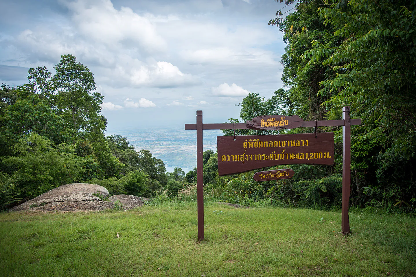
The main mountain of the park is Khao Luang, rising to approximately 1,200 metres above sea level.
It is not part of a huge continuous mountain chain. Instead, it rises distinctly from the surrounding lowlands, making it visually prominent from a considerable distance.
The mountain extends roughly north–south and forms an important watershed for streams that eventually flow toward the Yom River. The summit area contains natural grassland interspersed with forest and rocky terrain.
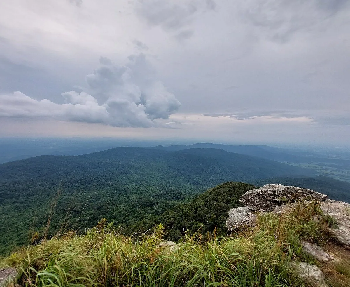
From the upper slopes, the landscape opens dramatically. The flat plains below suddenly seem very far away.
The Four Peaks of Khao Luang
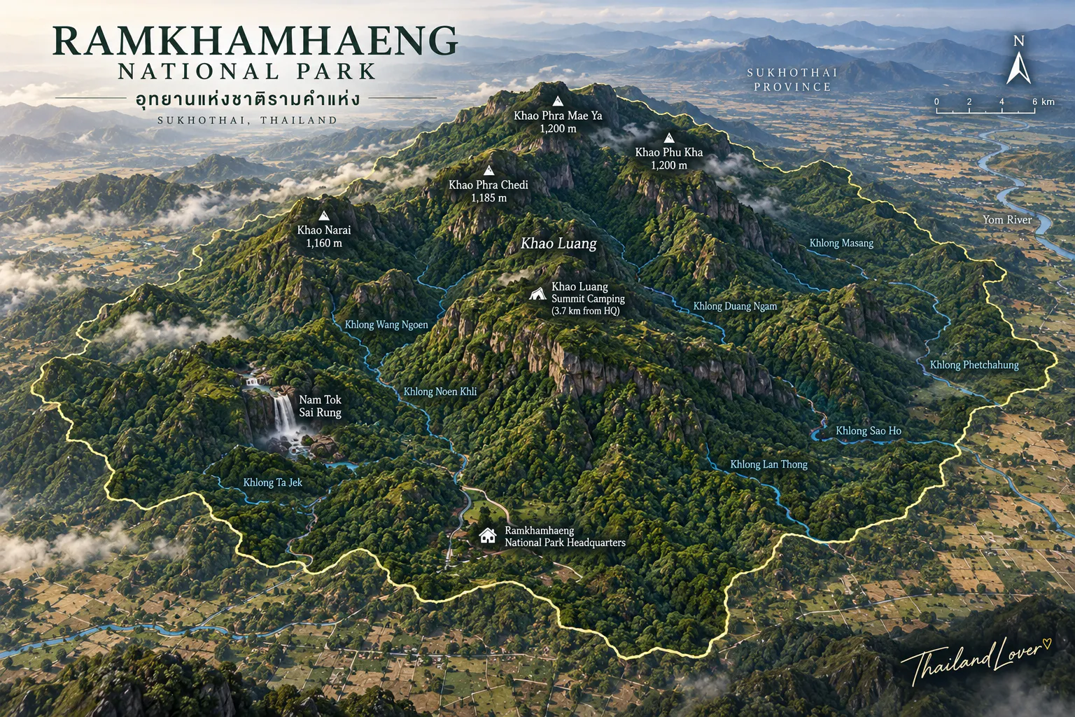
The summit area is not a single pointed summit. It consists of four significant high points.
1. Narai Peak
ยอดเขานารายณ์ · Approximately 1,160 m
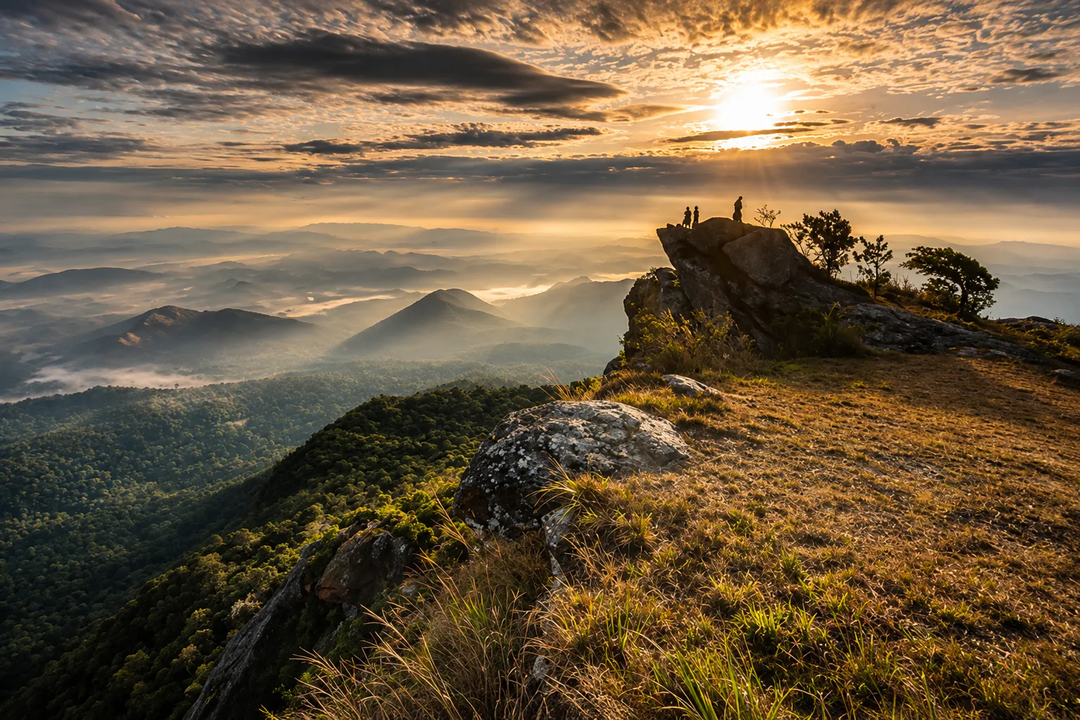
Narai Peak is associated with broad views across the surrounding landscape, and is one of the best places to experience sunrise.
The view changes dramatically with weather. On clear mornings, the Sukhothai plains spread into the distance. On misty mornings, the valleys become a white sea beneath the mountain.
2. Phra Mae Ya Peak
ยอดเขาพระแม่ย่า · Approximately 1,200 m
Phra Mae Ya Peak carries an important cultural association with Mae Ya, a revered figure in Sukhothai tradition. The mountain and the legend surrounding Mae Ya illustrate how geography and cultural memory can become inseparable.
It is not simply another viewpoint. It is a place where the physical mountain connects with the identity of Sukhothai.
3. Phu Ka
ภูกา · Approximately 1,200 m
Phu Ka provides another perspective over the mountain landscape. The surrounding vegetation, open grassland and distant ridges create a very different atmosphere from the lower forest.
4. Phra Chedi Peak
ยอดเขาพระเจดีย์ · Approximately 1,185 m
Phra Chedi is the fourth major high point. Together, the four peaks form the distinctive summit landscape of Khao Luang.
The 3.7-Kilometre Khao Luang Trail
Short on the Map. Serious on the Mountain.
The distance from park headquarters to the upper Khao Luang area is approximately 3.7 kilometres. That number can be misleading.
This is not a gentle forest walk. The trail climbs continuously and contains several steep sections. For experienced hikers, it is a relatively short mountain ascent. For visitors who do not regularly hike, the gradient is the real challenge.
What the trail feels like
The lower section begins in forest. As you gain elevation, the vegetation gradually changes. You pass:
- Large trees
- Roots and rocks
- Steeper slopes
- Forest clearings
- Rest areas
- Higher-elevation vegetation
Eventually the forest opens toward the summit landscape. That transition is one of the best parts of the hike.
You begin below the canopy. Then the sky becomes larger. The air becomes cooler. And the landscape begins to open.
Along the Mountain Route
Sai Ngam
ไทรงาม · The Giant Banyan
Sai Ngam is a large banyan tree encountered along the route toward Khao Luang. Its spreading branches and extensive canopy create a natural resting place.
It is a good reminder that the mountain experience is not only about reaching the summit. Sometimes the most memorable moments happen when you stop walking.
Sit beneath the tree. Listen to the forest. Then continue upward.
Plong Nang Nak
ปล่องนางนาค · A Natural Opening in the Mountain
Approximately 320 metres beyond Sai Ngam is Plong Nang Nak, a narrow natural opening in the mountain. It is only around half a metre wide and approximately 1.5 metres long, while its full depth cannot be measured from the surface.
The feature is associated with the Phra Ruang legend recorded in northern chronicles and local tradition. Whether experienced as geology or folklore, the site adds another layer to the mountain.
The rock itself is natural. The story attached to it is cultural.
The Natural Grasslands of Khao Luang
One of the most striking changes at the summit is the appearance of open natural grassland. The Department of National Parks describes extensive grass-covered areas around the upper mountain, interspersed with forest and shrubs.
This creates a landscape very different from the dense woodland lower down.
At sunrise, the grass catches warm light. When mist arrives, the open landscape can feel almost alpine. In the dry season, the colours become more muted. In the wet season, the mountain turns greener.
Sunrise, Sunset & the Sea of Mist
Sunrise above the Sukhothai plains
Sunrise is one of the strongest reasons to spend a night on the mountain. From the upper viewpoints, you can watch the light move across the plains below — and Narai Peak is particularly associated with sunrise views.
The experience becomes especially atmospheric when mist forms in the valleys. Instead of seeing individual fields and villages, you see:
White mist → dark ridges → distant horizon → rising sun
Sunset on Khao Luang
The mountain is equally interesting in the late afternoon. As the sun moves toward the horizon, the landscape changes from bright green to warm gold. Phra Mae Ya Peak is commonly used as a sunset viewpoint.
The mountain becomes quieter. The temperature drops. And the surrounding plains gradually disappear into evening haze. If you are camping overnight, this is one of the best reasons not to rush back down.
Sea of mist
Mist is highly weather-dependent, but Khao Luang can produce beautiful morning cloud formations. The effect is strongest when moist air accumulates over the lower plains while the summit remains above the cloud layer — the result can look like a sea of white beneath the mountain.
- Best conditions
- Cool mornings, high humidity, recent rainfall, and clear or partly clear skies above the valley.
A mountain forecast can never guarantee a sea of mist. That uncertainty is part of the experience.
Sai Rung Waterfall
น้ำตกสายรุ้ง · The Rainbow Waterfall
Sai Rung Waterfall is the park’s best-known waterfall. Its name means “Rainbow Waterfall.”
Water originating around the Phra Chedi mountain area flows through the forest before dropping over a high rocky section. When sunlight hits the falling water at the right angle, a rainbow can appear in the spray — when sunlight, water spray and viewing angle come together.
Local information places the strongest rainbow viewing period around late morning to afternoon, roughly 11:00–16:00, but this depends on weather and sunlight rather than being a fixed daily event. The waterfall has several levels and is best experienced when water flow is sufficient.
Sai Rung in the rainy season
The waterfall becomes much more impressive when rainfall has replenished the mountain streams, and the surrounding forest turns greener. This makes the rainy season visually attractive, although slippery trails and changing water conditions require more caution.
If you are visiting specifically for the waterfall, check current conditions before travelling.
Nature Trail
A Softer Way to Experience the Park
Not everyone needs to climb Khao Luang. The park also has a nature-study route beginning around headquarters — approximately 3 kilometres, taking around 2 hours, according to local park information.
- Herbal gardens
- Dry evergreen forest
- Sai Ngam, the giant banyan
- Soil layers
- Rock formations
- Forest ecosystems
It is a useful alternative for visitors who want to experience the ecology without undertaking the full summit climb.
The Historical Landscape of Ramkhamhaeng
This is where Ramkhamhaeng becomes genuinely distinctive. The Department of National Parks describes it as a historical national park, containing archaeological and cultural remains associated with the Sukhothai period.
The forest is not simply a natural backdrop. It contains traces of human movement, belief and landscape use.
The Four Historical Gates
Local historical interpretation identifies four traditional gateways around the mountain landscape:
- Pratu Pa
- The northern gate.
- Pratu Makha
- Associated with the western side and a former frontier area.
- Pratu Plauey
- Located toward the eastern side.
- Pratu Phra Ruang
- The southern gate, associated with a local legend of Phra Ruang playing with a kite.
These sites are best understood as part of the historical and local tradition of the Khao Luang landscape, documented in local cultural and tourism records — not as intact monumental city gates.
Sacred Sites on the Mountain
The Buddha Footprint
รอยพระพุทธบาท · A Sacred Mark on the Mountain
Near the base of Tham Phra Bat is a carved Buddha footprint on slate, decorated with the traditional 108 auspicious symbols.
Local historical documentation associates it with the reign of King Maha Thammaracha I (Li Thai) during the Sukhothai period and places its age at roughly six centuries.
It shows that the mountain was not merely a wilderness surrounding Sukhothai. It was part of the cultural landscape itself.
Khao Pu Ja Prang
ปรางค์เขาปู่จ่า · An Older Monument Near the Mountain
Khao Pu Ja Prang is a brick-built prang on a small hill near the park. It is associated with Khmer Baphuon-style architecture and is generally described in local sources as an early religious monument connected with travellers and ritual activity.
Its presence adds another chronological layer. The region’s cultural history did not begin with the Sukhothai kingdom — the area was connected to wider mainland Southeast Asian cultural networks before the rise of Sukhothai.
Tham Phra Narai
ถ้ำพระนารายณ์ · Cave, Art & History
Tham Phra Narai is a cave associated with the discovery of a sculptural image identified by earlier discoverers as Phra Narai. Later interpretation identifies the image as an Avalokitesvara / Bodhisattva figure.
The original sculpture is no longer intact; local documentation records that only its base remains. It is a good example of why historical sites should be treated carefully — not every legend or early identification reflects modern archaeological interpretation.
Tham Phra Mae Ya
ถ้ำพระแม่ย่า · A Sacred Landscape
Tham Phra Mae Ya is a large rock shelter historically associated with the image of Mae Ya. The image was later moved to the Mae Ya Shrine in Sukhothai city, in front of the provincial government complex.
The cave and the mountain peak carrying her name remain part of the broader cultural landscape of Sukhothai’s Mae Ya tradition.
Suan Lum / Suan Lumbini
สวนลุมพินี · The Mountain’s Herbal Garden
At the foot of Khao Luang is an area historically known as Suan Lum, also called Suan Lumbini, associated with medicinal plants and traditional herbs. Today, it forms part of the park headquarters zone.
The park records a variety of medicinal and traditional plants, reflecting the importance of forest resources to local knowledge.
Phra Ruang Road
ถนนพระร่วง · An Ancient Route Across the Sukhothai Landscape
One of the most fascinating historical connections is Phra Ruang Road, the traditional route associated with the ancient road linking the historical centres of Kamphaeng Phet, Sukhothai and Si Satchanalai. Local historical sources describe it as approximately 123 kilometres long.
It reflects the strategic and administrative connections between the major cities of the Sukhothai period.
Rather than imagining Sukhothai as an isolated ancient city, the road reminds us that the kingdom was connected by routes crossing the surrounding landscape.
Forests of Ramkhamhaeng
The park contains several forest types distributed according to elevation and moisture.
- Dry Dipterocarp Forest
- The dominant forest type, on drier slopes and ridges — Shorea, Dipterocarpus and other dry-forest trees.
- Mixed Deciduous Forest
- Found mainly along valleys and moderately moist areas.
- Dry Evergreen Forest
- In more humid valleys and areas with moisture for much of the year.
- Montane Forest
- Patches of montane vegetation around the upper mountain.
The changing forest types are one reason the relatively short climb to Khao Luang feels like a much longer ecological journey.
Wildlife
Ramkhamhaeng protects a substantial forest ecosystem despite its proximity to Sukhothai’s historic urban landscape. Park records include:
- Muntjac
- Wild boar
- Northern pig-tailed macaque
- Civets
- Leopard cats and other small carnivores
- Giant pangolin
- Squirrels
- Monitor lizards
- Snakes
- Frogs and amphibians
Wildlife encounters are not guaranteed. The best approach is to walk quietly and treat animal sightings as a bonus rather than the purpose of the trip.
Birds of the mountain
The forest supports leafbirds, drongos, flycatchers, bulbuls, woodpeckers, cuckoos, warblers and many other forest species. The summit grassland creates a different habitat from the lower forest.
Early morning is the best time for birdwatching — bring binoculars if it is part of your itinerary.
The Mountain as a Watershed
Khao Luang is not only a scenic mountain. It is an important watershed, with streams originating in the park eventually contributing to waterways flowing toward the Yom River.
- Khlong Ta Jek
- Khlong Sao Ho
- Khlong Wang Ngoen
- Khlong Noen Khli
- Khlong Duang Ngam
- Khlong Lan Thong
- Khlong Ma Sang
- Khlong Phet Rueang
This makes forest conservation important far beyond the park boundary.
When to Visit
- November–February · Cool Mountain Season
- The most comfortable period for hiking: cool mornings, cold nights at the summit, potential mist and comfortable daytime conditions. December and January are typically among the coolest months.
- June–October · Green Mountain Season
- Greener forest, fuller streams, better waterfall conditions and more atmospheric mist — but higher humidity, slippery trails, and access that can change with conditions.
- March–May · Hot Season
- Lower elevations become hot. The summit is cooler, but the climb is still demanding. Start early and carry sufficient water.
How Difficult Is Khao Luang?
Moderate to Challenging
The distance is only about 3.7 km, but the trail is steep. The gradient — not the distance — is the main challenge.
- Suitable for
- Regular walkers, hikers with reasonable fitness, experienced trekkers and travellers prepared for a steep ascent.
- Requires extra preparation for
- First-time hikers, young children, older travellers and anyone unused to steep terrain.
You do not need mountaineering equipment. But you should not treat it as a casual sightseeing walk.
Overnight on Khao Luang
The Mountain After Sunset
One of the best ways to experience Ramkhamhaeng is to stay overnight. The park lists a camping area at the Khao Luang summit, approximately 3.7 km from headquarters. An overnight trip gives you three different experiences:
- Evening
- Sunset over the plains.
- Night
- A much darker mountain environment, far from city lights.
- Morning
- Sunrise and, when conditions cooperate, a sea of mist.
This is considerably more immersive than climbing up and immediately returning.
Camping at the summit
The park’s reservation information lists:
- Summit camping area
- Three-person rental tents
- Sleeping bags
- Sleeping mats
- Pillows
The headquarters also has accommodation for visitors who prefer not to camp. Check availability before travel, particularly for weekends and holiday periods.
A Perfect 2-Day Ramkhamhaeng Itinerary
Day 1 — Into the Mountain
- Morning
- Arrive at Ramkhamhaeng National Park. Register and prepare your hiking equipment.
- Late morning
- Begin the 3.7-km ascent.
- Midday
- Continue through the forest toward the summit.
- Afternoon
- Reach the upper camping area. Rest and explore the four peaks.
- Late afternoon
- Walk toward Phra Mae Ya Peak for sunset, if conditions and park rules permit.
- Night
- Camp beneath the mountain sky.
Day 2 — Sunrise & Descent
- Early morning
- Walk to Narai Peak and watch the sunrise. If the weather cooperates, look for the sea of mist below.
- Morning
- Explore the remaining summit landscapes, then return to camp.
- Late morning
- Descend the 3.7-km trail.
- Afternoon
- Explore lower-elevation attractions such as Sai Rung Waterfall or the nature trail, depending on current access and conditions.
A one-day alternative
Early morning → climb Khao Luang → explore the summit → descend → waterfall or lower park
This is possible for fit hikers, but it makes for a long day. Do not start late.
Photography Guide
- Sunrise · Narai Peak
- Mountain silhouettes, sea of mist, golden light and wide landscapes.
- Sunset · Phra Mae Ya Peak
- Warm mountain light, long shadows, the Sukhothai plains and atmospheric haze.
- Forest
- Combine tree trunks, the trail and a human figure for scale to show the steepness and depth of the mountain.
- Sai Rung Waterfall
- Shoot when sunlight reaches the falling water — the rainbow depends on sun angle, water spray and your viewing position.
What to Bring
For the summit
- Hiking shoes
- 2–3 litres of water, or enough for current park conditions
- Lightweight food
- Warm jacket
- Rain jacket
- Headlamp
- Personal medicine
- Insect repellent
- Sun protection
- Power bank
- Camera
- Small first-aid kit
- Personal rubbish bag
For overnight camping
- Warm layers
- Sleeping equipment, if not renting
- Dry clothes
- Waterproof bag
The summit can feel genuinely cold at night, even when the lowlands are warm.
Getting There
Ramkhamhaeng National Park is approximately 30–40 km from Sukhothai city, depending on the route and destination.
Sukhothai → Highway 101 → Khiri Mat → park turn-off → about 16 km to headquarters
From Sukhothai, the main approach follows Highway 101 toward Khiri Mat. From the south (via Kamphaeng Phet), Highway 101 also reaches Khiri Mat, where you turn off toward the park.
- From Sukhothai Historical Park
- Allow roughly 1–1.5 hours, depending on traffic and exact starting point.
- From Bangkok
- A road trip is possible, but it is a substantial journey. The most logical combination is Sukhothai Historical Park plus Ramkhamhaeng National Park.
Where to Stay
- Inside the national park
- Three park houses in the headquarters zone — Ramkhamhaeng 104, 105 and 106 — plus summit camping.
- Sukhothai city
- Hotels, restaurants, cafés, easy access to the historical park and more comfortable accommodation.
- Khiri Mat
- A useful option for travellers who want to stay closer to the national park.
Responsible Travel
Ramkhamhaeng is both a protected forest and a culturally significant landscape. Please:
- Stay on designated trails
- Do not remove rocks or plants
- Do not collect archaeological objects
- Do not touch or damage historical remains
- Do not feed wildlife
- Carry your rubbish back out
- Keep noise low
- Follow seasonal closures
- Respect sacred places
Fire & Conservation
The park has experienced serious wildfire pressure. In April 2026, a significant wildfire affected the Khao Luang area, and the Department of National Parks later reported the rescue and successful release of a young muntjac that had survived the fire.
The mountain is not simply a backdrop for hiking. It is a living ecosystem vulnerable to fire, drought and human activity.
Essential Information
- Destination
- Ramkhamhaeng National Park
- Thai Name
- อุทยานแห่งชาติรามคำแหง
- Alternative Name
- Khao Luang Sukhothai
- Province
- Sukhothai
- Districts
- Khiri Mat, Ban Dan Lan Hoi & Mueang Sukhothai
- Area
- 213,125 rai / approximately 341 km²
- Established
- 27 October 1980
- National Park No.
- 18
- Highest Elevation
- Approximately 1,200 m
- Main Mountain
- Khao Luang
- Four Peaks
- Narai, Phra Mae Ya, Phu Ka & Phra Chedi
- Main Hiking Route
- Approximately 3.7 km to the upper Khao Luang area
- Main Waterfall
- Sai Rung Waterfall
- Historical Features
- Historical gates, Buddha footprint, caves, Khao Pu Ja Prang and Phra Ruang Road
- Best For
- Hiking, camping, sunrise, mist, history, nature and photography
- Recommended Stay
- 2 days / 1 night
- Difficulty
- Moderate to challenging — steep ascent
- Best Season
- Cool season for comfortable hiking; rainy season for green forest and waterfalls
- Headquarters
- 124 Moo 2, Khiri Mat, Sukhothai 64160
- Park Telephone
- +66 98 883 9297
Before You Go
Ramkhamhaeng is a destination where seasonal access matters. The summit route, waterfall areas and camping facilities can be affected by:
- Weather
- Wildfire risk
- Heavy rain
- Trail conditions
- Seasonal conservation closures
- Camping capacity
- Park management regulations
Entrance fees and summit opening dates change from time to time, and special fee exemptions are sometimes announced for national occasions. Check the latest Department of National Parks announcement or call the park before travelling.
Frequently Asked Questions
- What is Ramkhamhaeng National Park?
- Ramkhamhaeng National Park, or อุทยานแห่งชาติรามคำแหง, is Thailand’s 18th national park, established on 27 October 1980 in Sukhothai Province. It covers about 341 km² (213,125 rai) around Khao Luang, a solitary mountain of about 1,200 metres, and protects both forest and Sukhothai-era historical sites.
- How long is the Khao Luang hike?
- The trail from park headquarters to the upper Khao Luang area is about 3.7 km, but it climbs steeply almost the whole way. Most hikers need roughly 3–5 hours for the ascent, depending on fitness, weather and trail conditions.
- How difficult is the Khao Luang trail?
- Moderate to challenging. The distance is short, but the gradient is the real challenge. No mountaineering equipment is needed, but first-time hikers, young children and older travellers should prepare well and start early.
- What are the four peaks of Khao Luang?
- Narai Peak (about 1,160 m), Phra Mae Ya Peak (about 1,200 m), Phu Ka (about 1,200 m) and Phra Chedi Peak (about 1,185 m). Narai is known for sunrise and Phra Mae Ya for sunset.
- Can you camp on Khao Luang?
- Yes. The park lists a summit camping area about 3.7 km from headquarters, with three-person rental tents, sleeping bags, mats and pillows. Park houses are also available at headquarters. Check availability and seasonal summit access before travelling.
- When is the best time to visit?
- November to February is the most comfortable season for hiking, with cool mornings, cold summit nights and a chance of mist. June to October brings greener forest and stronger waterfalls but slippery trails. March to May is hot at lower elevations.
- How do I get there?
- The park is about 30–40 km from Sukhothai city. Follow Highway 101 to Khiri Mat District, then turn off for about 16 km to park headquarters. Allow roughly 1–1.5 hours from Sukhothai Historical Park.
- What is Sai Rung Waterfall?
- Sai Rung, meaning Rainbow Waterfall, is the park’s best-known multi-level waterfall. Rainbows can appear in the spray when sunlight hits the water, most often from late morning to afternoon, and the falls are strongest after rain.
Related Destinations
- Si Satchanalai National Park
- Sukhothai’s other mountain park — forest, waterfalls and caves in the north of the province.
- Khlong Lan National Park
- Big waterfalls and western forest in neighbouring Kamphaeng Phet, at the other end of the Phra Ruang Road.
- Mae Wong National Park
- High ridges and the Mokoju summit trek for hikers who want a longer mountain challenge.
- Sukhothai Province
- The historical park, old city and everything else around the first Thai kingdom.
- Nature & Parks
- More protected landscapes across ThailandLover’s national-park collection.
Location
Find Ramkhamhaeng National Park
124 Moo 2, Khiri Mat, Khiri Mat District, Sukhothai 64160