


Proposed National Park · Songkhla
San Kala Khiri National Park
อุทยานแห่งชาติสันกาลาคีรี
Songkhla’s Hidden Forest on the Malaysian Border
Saba Yoi District · Songkhla · Southern Thailand
Beyond Songkhla’s beaches, old town and busy southern cities lies a very different landscape — rainforest, rivers, caves, wildlife and borderland history.
Another Songkhla
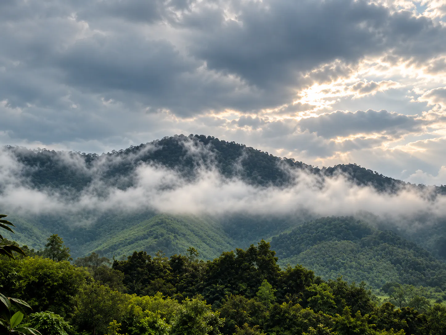
The mountains of San Kala Khiri rise along the southern border of Thailand, forming a dense tropical forest landscape connected ecologically with forests on the Malaysian side.
Here, streams begin in the mountains. Caves disappear into limestone hills. The Thepha River system begins in the forest. And deep among the trees are traces of communities and history that existed long before the area became a destination for modern travellers.
This is San Kala Khiri — a remote southern forest landscape where rainforest, rivers, caves, wildlife and borderland history come together.
It is not a conventional sightseeing park. It is a place for travellers who want to see a quieter, less-developed side of southern Thailand.
Rainforest. Rivers. Caves. Borderland history.
At a Glance
- ~146 km²
- Proposed area — approximately 91,381.20 rai.
- ~500 m
- Khuan Kamphaeng, the highest point identified in the area.
- 1 river
- The forest is a headwater area of the Thepha River.
- 1 border
- Forests connected with Malaysia across the Thai–Malaysian frontier.
- Name
- San Kala Khiri National Park
- Thai Name
- อุทยานแห่งชาติสันกาลาคีรี
- Province
- Songkhla
- District
- Saba Yoi
- Mountain Range
- San Kala Khiri Range
- Proposed Area
- Approximately 91,381.20 rai / 146 km²
- Highest Point
- Khuan Kamphaeng, approximately 500 m
- Main Ecosystem
- Humid evergreen forest
- Major Watershed
- Thepha River
- Border Region
- Thailand–Malaysia
- Signature Experiences
- Rainforest · caves · streams · Ban Si Hui · Bang Thepha · waterfalls · birdwatching · forest trails
The San Kala Khiri Mountains
Southern Thailand’s forested border range
The San Kala Khiri Range forms part of the mountainous landscape along the Thailand–Malaysia border. Unlike the dramatic high mountains of northern Thailand, these southern mountains are relatively low but exceptionally green.
- Steep forested hills and narrow valleys
- Humid evergreen forest
- Rocky streams and small waterfalls
- Limestone formations and caves
- Dense vegetation
The highest point identified in the area is Khuan Kamphaeng, at approximately 500 metres above sea level. The mountains matter more for their forests and watershed functions than for extreme elevation.
This is a rainforest landscape rather than a high-mountain destination.
A Forest That Gives Birth to a River
The Thepha River watershed
One of San Kala Khiri’s most important roles is ecological rather than recreational. The forest is an important headwater area of the Thepha River.
Rain falling on the mountains is captured by the forest, filtered through the soil and rocks, and gradually released into streams that feed the river system. The forest therefore supports:
- Water
- Streams that feed the Thepha River system.
- Wildlife
- Habitat for forest mammals, birds, reptiles and amphibians.
- Agriculture
- Water for farms in the lowlands.
- Communities
- Villages and towns downstream.
- Biodiversity
- Part of a wider regional forest system.
DNP specifically identifies the area as an important watershed forest for the Thepha River and a significant terrestrial ecosystem.
Not simply a forest to look at — a forest that keeps the landscape alive downstream.
The Humid Evergreen Forest
A different side of southern Thailand
The dominant natural vegetation is humid evergreen forest, creating a very different atmosphere from the dry forests of central and northeastern Thailand. DNP describes the forest as dense and rich in plant species, including valuable and relatively rare trees.
Expect:
- Dense tree canopies and large tropical trees
- Vines, ferns and moss
- Moist forest floors and deep shade
- Small streams
- High humidity
For photographers, the forest is often more interesting in its details than in a single panoramic viewpoint. Look for leaves after rain, roots and vines, rocky streams, moss-covered surfaces, filtered forest light and birds moving through the canopy.
Bang Thepha
บางเทพา · where two waters meet
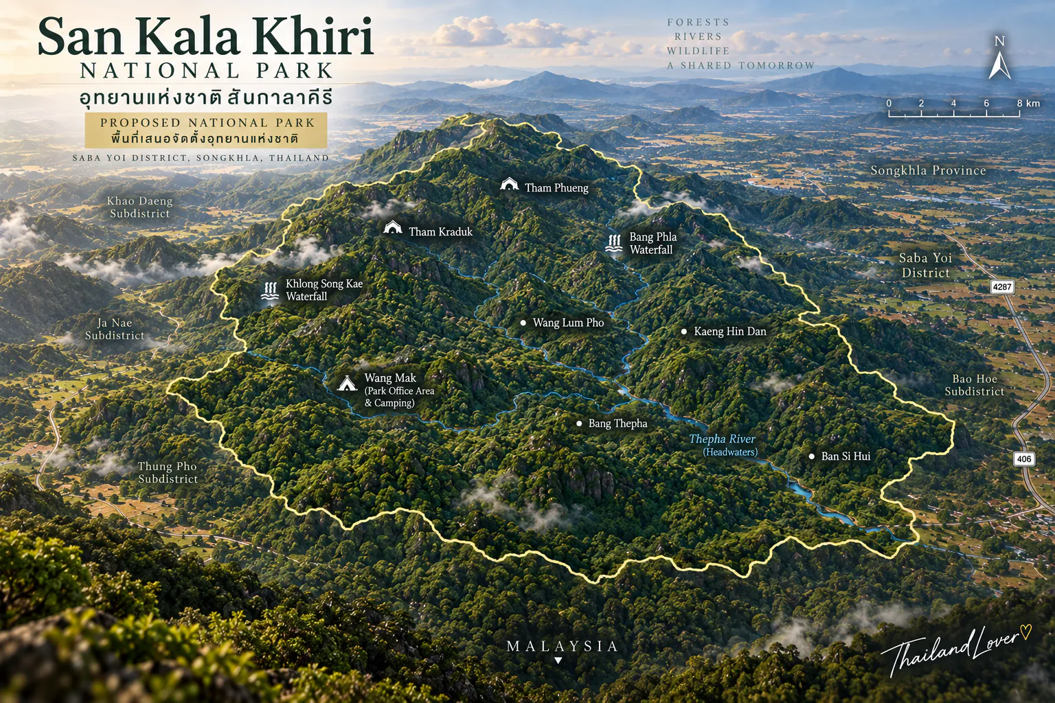
Bang Thepha is one of the area’s natural highlights. Two streams meet here, creating a sandy riverside area where the water opens into a more spacious landscape.
It is one of the places where visitors can clearly understand the relationship between mountain, stream and river. DNP identifies Bang Thepha among the area’s natural attractions and describes it as a sandy area created where two waterways converge.
It is also one of the more photogenic landscapes for travellers who enjoy quiet river scenery rather than large waterfalls.
Mountain → stream → river.
Forest, Water & Stone
Wang Mak · Wang Lum Pho · Kaeng Hin Dan
- Wang Mak
- An open section of landscape where streams from the Thepha system converge, shaded by the surrounding forest — a natural place to feel the coolness of the southern rainforest. In wetter periods the streams become more energetic; in drier conditions, rocks and shallow channels become more visible.
- Wang Lum Pho
- A broad area on both sides of a stream, shaded by large trees. It is not a monumental waterfall — its appeal is its atmosphere. Large trees, running water and forest shade make it a slow-travel stop, not a sight to be rushed through.
- Kaeng Hin Dan
- A rocky stream where water flows across a broad area of dark stone. The contrast between black rock, clear water and dense green vegetation makes it one of the most distinctive natural scenes here. Water levels are seasonal, so the rapids and exposed rock change through the year.
DNP lists Wang Mak, Wang Lum Pho and Kaeng Hin Dan among San Kala Khiri’s natural attractions.
Waterfalls
Khlong Songae & Bang Phla
San Kala Khiri contains several smaller waterfalls and forest streams. Two named attractions identified by DNP are:
- Khlong Songae Waterfall
- A forest waterfall on the park’s stream system. Its character depends strongly on rainfall, making the rainy season particularly important for waterfall scenery.
- Bang Phla Waterfall
- Another natural waterfall within the forest landscape.
Rather than expecting a massive cascade, approach these waterfalls as part of a wider forest-and-stream experience.
Ban Si Hui
บ้านสี่หุย · a forest community remembered by the landscape
One of San Kala Khiri’s most unusual attractions is not a waterfall or viewpoint. It is Ban Si Hui — the remains and memory of an old forest settlement.
Historical accounts describe a community that once lived deep within the San Kala Khiri forest. Over time, disease and difficult living conditions contributed to the disappearance of the settlement.
Today, the site gives a human dimension to the forest. It was not always an empty wilderness. People lived here. They travelled through these mountains. They depended on the streams. They built a community. And eventually, the forest reclaimed much of the landscape.
DNP specifically identifies Ban Si Hui as one of the area’s historical and archaeological attractions.
For travellers interested in cultural landscapes, this may be San Kala Khiri’s most meaningful stop.
Tham Kraduk
ถ้ำกระดูก · the Bone Cave
Tham Kraduk, literally Bone Cave, is associated with the history of Ban Si Hui. It lies approximately 1 kilometre from the Ban Si Hui area, according to local travel documentation.
Its significance is connected to the remains of people from the former community, which makes it very different from a typical tourist cave. DNP identifies Tham Kraduk as an important historical and archaeological site within the proposed park.
Tham Phueng
ถ้ำผึ้ง · the Honey Cave
Tham Phueng, or Honey Cave, is a limestone cave whose name comes from the bees and honey found in the cave environment. It brings together the elements that define San Kala Khiri: limestone, forest, wildlife, water and local knowledge.
DNP lists Tham Phueng among the area’s historical and natural attractions.
Tham Talot
Limestone country beneath the forest
The Tham Talot area is associated with Ban Tham Talot and Wat Tham Talot. Here, limestone mountains create caves and rock formations beneath the surrounding forest, and some cave sections contain stalactites and stalagmites — evidence of the slow geological processes that shape southern Thailand’s limestone landscapes.
Natural and cultural landscapes overlap here:
- Limestone mountain
- The rock that shapes the land.
- Caves
- Hollowed out over long geological time.
- Forest
- Covering the hills above.
- Temple & community
- Wat Tham Talot and the village around it.
It makes a useful addition to an itinerary exploring San Kala Khiri beyond the main park office.
Wildlife
A forest with elephants
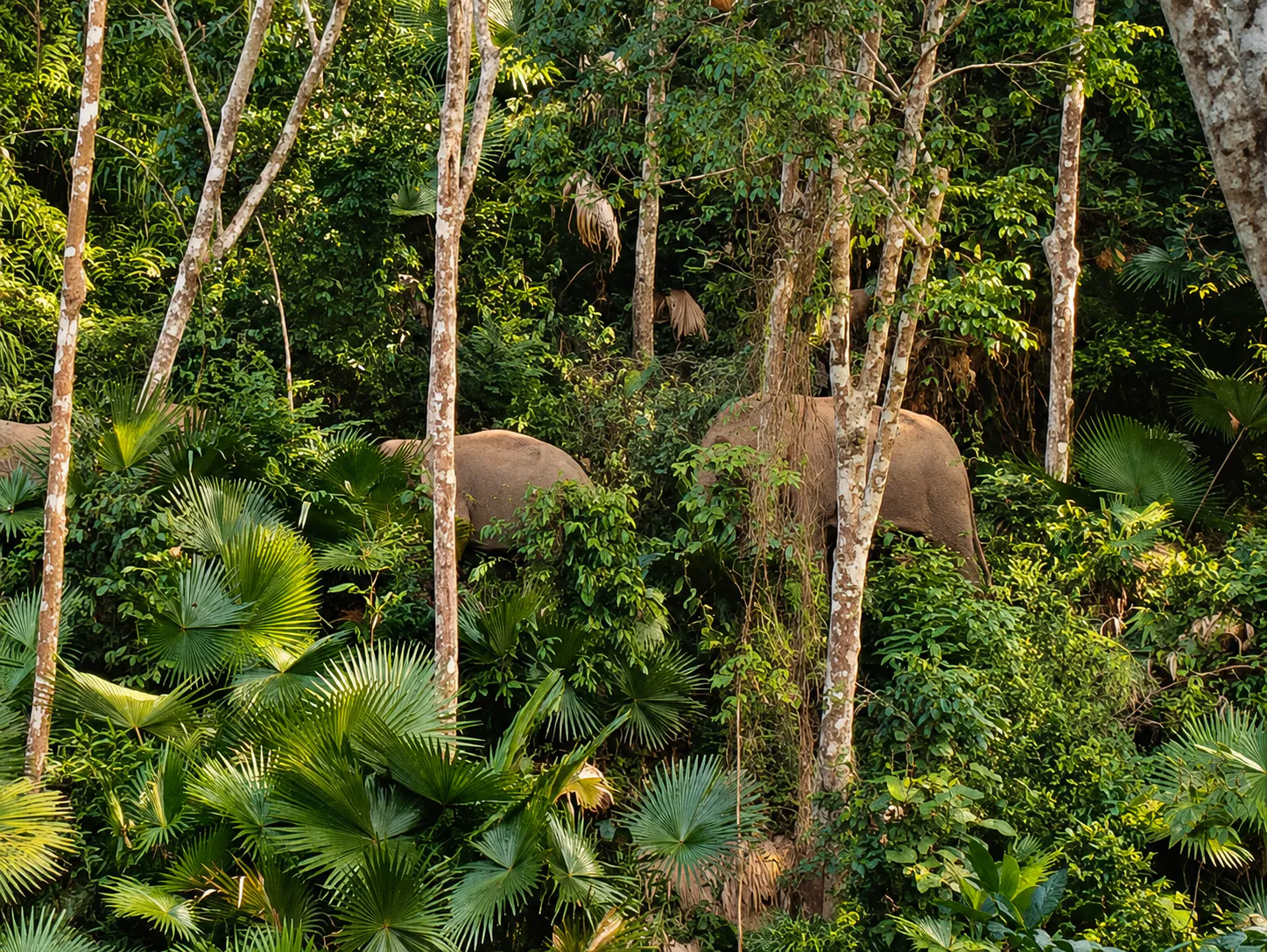
San Kala Khiri is part of an important forest landscape in southern Thailand and supports significant wildlife habitat. One species has become particularly visible in recent DNP reports: the Asian elephant.
Wild elephants move through the forest landscape around Saba Yoi. In 2025 and 2026, DNP reported several operations involving elephants moving outside protected forest areas and into agricultural areas, with park officers working with local communities to guide them back toward the forest.
San Kala Khiri is wildlife habitat first and a tourist destination second.
Elephants are wild animals. Never attempt to approach, feed, follow or photograph them at close range.
Other wildlife includes mammals, birds, reptiles and amphibians. Because of the dense vegetation and relatively low visitor numbers, wildlife encounters are unpredictable.
A Living Ecological Corridor
Thailand meets Malaysia
One of San Kala Khiri’s most important ecological characteristics is its connection with forests toward Malaysia. DNP identifies this natural cross-border forest connection as an important factor supporting regional biodiversity and providing habitat for plants and wildlife, including species with restricted distributions.
The forest belongs to a much larger ecological story:
- Southern Thailand
- Saba Yoi, Songkhla.
- San Kala Khiri Range
- The forested border mountains.
- Border forests
- Continuous forest across the Thailand–Malaysia frontier.
- Peninsular rainforest
- Part of the wider Southeast Asian rainforest belt.
This is one reason the area has conservation value far beyond its modest elevation.
What to Do
- 01 · Birdwatching
- DNP identifies birdwatching as one of the area’s activities. Listen before you look: start early, walk quietly, listen for calls, watch the canopy, check forest edges and streams, and avoid loud conversations. Morning is the most atmospheric time.
- 02 · Nature trails
- One documented route connects the Bang Thepha area toward Ban Si Hui, continuing toward Tham Kraduk and Tham Phueng. Weather, vegetation, security conditions and management can all affect routes — confirm current trail status with local officials first.
- 03 · Rafting & stream activities
- DNP has identified rafting and whitewater-style stream activities among the area’s potential recreation. Treat these as seasonal and locally managed, not a guaranteed daily attraction. Never enter fast-flowing streams after heavy rain without local guidance.
- 04 · Cave exploration
- Tham Kraduk, Tham Phueng and the Tham Talot area — always with respect, and with local guidance where required.
- 05 · Camping
- DNP identified the San Kala Khiri park-office area as a camping location during the park-development process. Expect forest surroundings, basic facilities, natural sounds, limited commercial infrastructure and weather-dependent conditions. Confirm availability before travelling.
Best Time to Visit
San Kala Khiri lies in the humid tropics of southern Thailand, so rainfall is the major factor in planning.
- Wet season
- The forest becomes intensely green and streams and waterfalls generally become more active. However, heavy rain can make forest roads, trails and cave access difficult or unsafe.
- Drier period
- The forest stays green, but trails and access roads are generally easier to manage. Streams may be lower, which can make walking and cave exploration more practical when conditions are suitable.
Getting There
- From Hat Yai
- For international travellers, Hat Yai is the most practical major transport hub. Travel toward Saba Yoi and continue toward the San Kala Khiri forest area. The route becomes increasingly rural as you approach the mountains.
- From Songkhla
- Travel south toward the Saba Yoi area and continue toward the forest. Road conditions and access to individual attractions can vary.
- From Malaysia
- The location near the border makes San Kala Khiri interesting for travellers combining southern Thailand with northern Malaysia. But being close to Malaysia does not mean visitors can cross the forest border — international crossings must be made only through authorised immigration points.
A Suggested Day
Forest + history
- Morning
- Hat Yai / Saba Yoi → San Kala Khiri forest → park office & camping area.
- Late morning
- Bang Thepha and the forest stream landscape.
- Afternoon
- Ban Si Hui → Tham Kraduk → Tham Phueng.
- Late afternoon
- Return through the forest to Saba Yoi.
This itinerary is deliberately slow. San Kala Khiri is not a destination where you should try to see ten attractions in a few hours.
A Deeper One-Day Experience
For travellers with more time:
Saba Yoi → San Kala Khiri Forest → Bang Thepha → Ban Si Hui → Tham Kraduk → Tham Phueng → Tham Talot / Wat Tham Talot → forest streams & waterfalls
This route combines the area’s four major themes:
- Forest
- The humid evergreen ecosystem.
- Water
- The Thepha watershed.
- Geology
- Limestone caves and rocky streams.
- History
- Ban Si Hui and Tham Kraduk.
Travel Tips
- Wear shoes with strong grip
- Forest trails, rocks and cave approaches can become extremely slippery after rain.
- Bring insect protection
- This is humid tropical forest.
- Carry drinking water
- Do not assume that every forest stream is safe to drink.
- Bring a flashlight
- Useful for cave approaches — but never shine powerful lights directly at wildlife.
- Start early
- Better for forest atmosphere, wildlife observation and heat management.
- Ask before entering caves
- Some caves may require local guidance or be unsuitable under current conditions.
- Do not approach elephants
- Recent DNP operations show wild elephants are active in the wider landscape.
- Respect the border
- Do not approach restricted border areas or try to cross into Malaysia through forest routes.
Responsible Travel
San Kala Khiri is particularly sensitive because it is at once a watershed, a wildlife habitat, a forest ecosystem, a historical landscape and a community landscape.
Do
- Take all rubbish out
- Stay on designated routes
- Respect historical remains and local communities
- Follow instructions from park officials
Do not
- Collect plants or rocks
- Disturb or feed wildlife
- Make loud noise
- Damage cave formations
The forest is more valuable than any photograph taken inside it.
What Makes San Kala Khiri Different?
Southern Thailand is often marketed through beaches. San Kala Khiri tells another story. There is no sea here. Instead, there are:
- Rainforests and mountain streams
- Limestone caves
- Elephants
- River headwaters
- Old settlements
- Border mountains
- Deep green silence
For travellers who want to understand the geography behind southern Thailand, this is a valuable detour.
A National Park in Development
The important legal distinction
Although DNP and local authorities commonly use the name “San Kala Khiri National Park”, the area is still in the process of being formally designated.
In November 2024, DNP announced public participation for the proposed designation, citing approximately 91,381.20 rai / 146 km² in Saba Yoi District. The process is governed by the National Park Act B.E. 2562 and requires Cabinet consideration and a Royal Decree before the area is formally established.
Essential Facts
- Location
- Saba Yoi District, Songkhla, Southern Thailand
- Mountain range
- San Kala Khiri Range
- Proposed protected area
- Approximately 91,381.20 rai / 146 km²
- Highest point
- Khuan Kamphaeng, approximately 500 m
- Main ecosystem
- Humid evergreen forest
- Main watershed
- Thepha River
- Border
- Thailand–Malaysia
- Key natural sites
- Bang Thepha · Wang Mak · Wang Lum Pho · Kaeng Hin Dan · Khlong Songae Waterfall · Bang Phla Waterfall
- Key historical sites
- Ban Si Hui · Tham Kraduk · Tham Phueng
- Other area of interest
- Tham Talot / Wat Tham Talot
- Activities
- Forest walking, cave exploration, birdwatching, camping and seasonal stream/rafting activities
- Wildlife
- Includes wild elephants and other forest fauna
- Current legal status
- Proposed national park — designation process ongoing
Frequently Asked Questions
- What is San Kala Khiri National Park?
- A remote forest landscape in Saba Yoi, Songkhla, on the Thailand–Malaysia border — rainforest, the Thepha River headwaters, limestone caves, streams, waterfalls, wild elephants and the historical site of Ban Si Hui.
- Is it an officially established national park?
- Not yet. DNP held public participation for the proposed designation in November 2024 (about 91,381.20 rai / 146 km²). Cabinet consideration and a Royal Decree under the National Park Act B.E. 2562 are still required.
- What are the main attractions?
- Bang Thepha, Wang Mak, Wang Lum Pho, Kaeng Hin Dan, Khlong Songae and Bang Phla waterfalls, plus the historical sites of Ban Si Hui, Tham Kraduk and Tham Phueng. Tham Talot and Wat Tham Talot are nearby.
- How do I get there from Hat Yai?
- Travel toward Saba Yoi District, then continue toward the San Kala Khiri forest. The road becomes increasingly rural — confirm access to individual sites locally.
- Are there wild elephants?
- Yes. DNP reported several elephant operations around Saba Yoi in 2025 and 2026. Never approach, feed, follow or photograph elephants at close range.
- When is the best time to visit?
- It depends on your priority. The wet season brings green forest and active waterfalls but harder access; drier periods are easier for walking and caves. Check local conditions before you go.
- Can I camp?
- DNP identified the park-office area as a camping location. Facilities are basic — confirm current availability before travelling.
More of the Deep South’s Wild Forests
- Khao Nam Khang National Park
- Songkhla’s other border forest, known for its historic tunnels near the Malaysian frontier.
- Bang Lang National Park
- Rainforest, reservoir and misty viewpoints in Yala.
- Thale Ban National Park
- A forest lake and rainforest trails on the Satun–Malaysia border.
- Budo–Su-ngai Padi National Park
- Lowland rainforest and waterfalls in Narathiwat.
Location
Find San Kala Khiri National Park
Saba Yoi District, Songkhla · on the Thailand–Malaysia border, south of Hat Yai