

Nature & Parks · Chaiyaphum
Sai Thong National Park
อุทยานแห่งชาติไทรทอง
The Wildflower Highlands of Chaiyaphum
Chaiyaphum Province · Northeastern Thailand
Siam tulip meadows, sandstone cliffs, waterfalls and forest on the Phang Hoei and Phraya Pho ranges — where Thailand’s rainy season brings a whole mountain back to life.
When the Mountain Blooms
When Thailand’s rainy season arrives, the mountains of Chaiyaphum turn green.
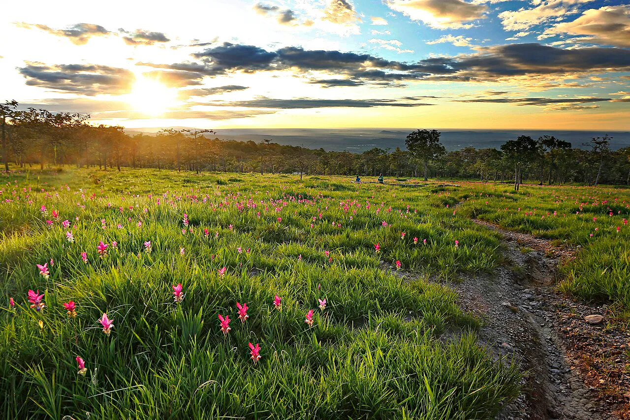
Then, almost as if the landscape has been painted overnight, fields of Dok Krachiao — Thailand’s famous Siam tulip — begin to bloom across the highland grasslands. This is Sai Thong National Park.
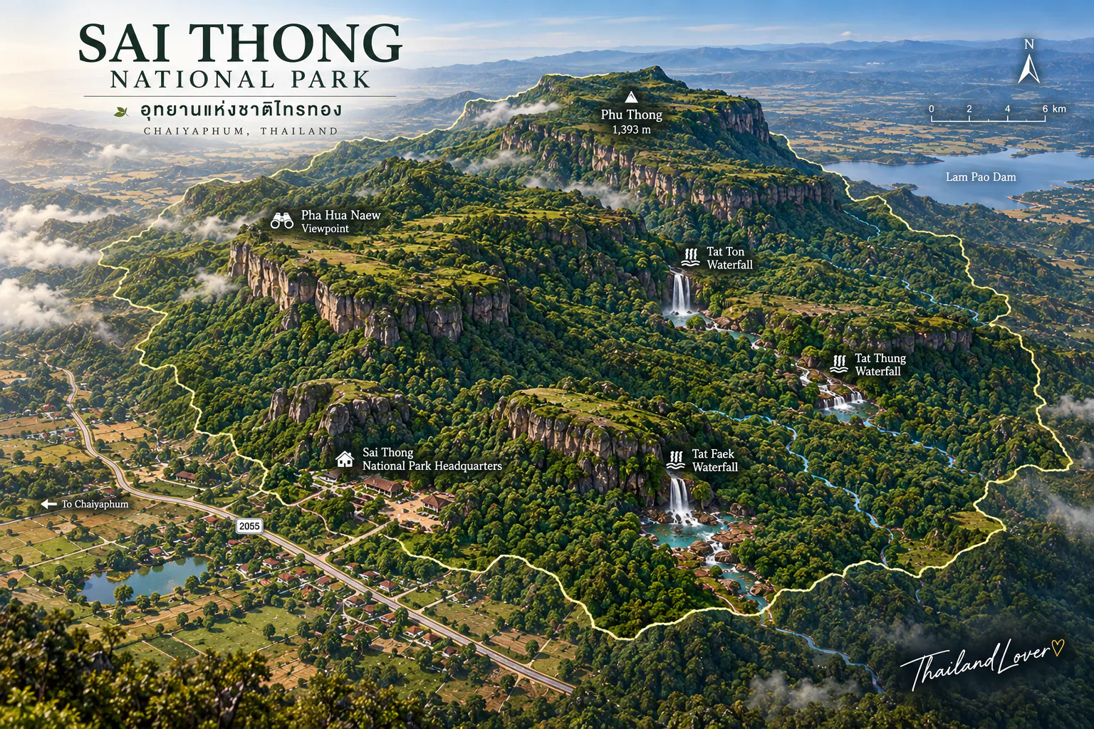
Spread across the rugged Phang Hoei and Phraya Pho mountain ranges, the park combines open mountain meadows, waterfalls, sandstone cliffs, forest and spectacular viewpoints. Its signature landscape is Thung Bua Sawan, where seasonal fields of pink-purple Dok Krachiao appear during the green season.
But Sai Thong is more than a flower destination. Walk beyond the fields and the landscape becomes wilder:
Flower meadow → forest → sandstone → cliff → waterfall → mountain horizon.
At its highest point, Phang Hoei Mountain reaches approximately 1,008 metres above sea level, opening broad views across the surrounding Chaiyaphum landscape. For travellers looking for an authentic rainy-season escape in Thailand, Sai Thong offers a particularly beautiful combination: wildflowers, mountains and open skies.
Sai Thong at a Glance
- ~319 km²
- About 199,375 rai across four districts of Chaiyaphum.
- ~1,008 m
- Phang Hoei Mountain — the park’s highest point.
- 77th
- Thailand’s national park number, declared 30 December 1992.
- Jun–Aug
- Main season for Dok Krachiao at Thung Bua Sawan.
- Location
- Chaiyaphum Province, Northeastern Thailand
- Districts
- Nong Bua Rawe, Thep Sathit, Phakdi Chumphon & Nong Bua Daeng
- Area
- 199,375 rai · approximately 319 km²
- Mountain ranges
- Phang Hoei & Phraya Pho
- Highest point
- Phang Hoei Mountain — approximately 1,008 m
- Established
- 30 December 1992 · Thailand’s 77th national park
- Signature landscape
- Thung Bua Sawan
- Signature flower
- Dok Krachiao / Siam tulip
- Main waterfall
- Sai Thong Waterfall
- Main viewpoint
- Pha Pho Mueang
- Best known for
- Wildflowers, waterfalls, cliffs, camping & mountain scenery
- Best season
- Green season, especially when Dok Krachiao is blooming
Why Visit Sai Thong?
Sai Thong is one of Thailand’s best examples of a seasonal mountain landscape — the same place can look completely different depending on when you arrive.
In the dry months, the mountains appear open and golden. When the rains arrive, the forest turns green. Then the Dok Krachiao blooms, creating one of the most recognisable landscapes in Chaiyaphum.
Come for
- Dok Krachiao flower fields at Thung Bua Sawan
- Sai Thong Waterfall
- Pha Pho Mueang and the mountain cliffs
- Phang Hoei mountain scenery
- Forest trails and seasonal wildflowers
- Camping under open skies
- Sunrise and mist
- Photography
The DNP describes Sai Thong as a forest landscape on the Phang Hoei range, with Dok Krachiao blooming across Thung Bua Sawan at the beginning of the rainy season.
The Mountain Landscape
Phang Hoei & Phraya Pho ranges
The terrain is not a single dramatic summit. Instead, numerous high and low ridges are arranged across the landscape, with elevations from roughly 300 metres to 1,008 metres. The highest point is Phang Hoei Mountain.
This variation in elevation creates several distinct environments:
- Lower forest and mountain slopes
- High grasslands and seasonal flower meadows
- Open sandstone areas and cliffs
- Streams and watercourses
That diversity is what makes Sai Thong more interesting than a simple flower-viewing stop.
Thung Bua Sawan
“Heavenly Lotus Meadow” — the flower fields of Sai Thong
The park’s signature attraction is Thung Bua Sawan, a highland meadow where Dok Krachiao blooms during the rainy season.
As rainfall arrives, the dormant plants emerge from the ground. Green leaves appear first. Then the flowers rise above the grass, and pink and purple tones spread gradually across the meadow.
The effect is subtle rather than artificial. It feels like the mountain itself is flowering.
Dok Krachiao — Thailand’s Rainy-Season Flower
Dok Krachiao, commonly translated as Siam tulip, is one of the iconic plants of Chaiyaphum. Despite its English name, it is not a true tulip: it belongs to the ginger family, Zingiberaceae, and is related to turmeric and other rhizomatous plants.
Its pink-purple flower bracts create the colour that visitors associate with Chaiyaphum’s mountains. The Tourism Authority of Thailand (TAT) describes Dok Krachiao fields as one of the province’s defining rainy-season attractions.
When Does Dok Krachiao Bloom?
Flowering is seasonal and weather-dependent. The flowers begin appearing in the early rainy season, with the main viewing period commonly around June–August — the same window TAT identifies for Dok Krachiao landscapes in the province.
Do not treat these months as a guarantee. Timing and intensity can change with:
- Rainfall and soil moisture
- Temperature and local weather
- Natural flowering cycles
Why the Flowers Are So Photogenic
The beauty of Thung Bua Sawan comes from contrast:
Pink-purple flowers against green grass, beneath dark mountain ridges, under a huge rainy-season sky.
That is why the best photographs are not necessarily close-ups. Step back. Show the flowers as part of the mountain — that is the real Sai Thong landscape.
Pha Pho Mueang
The cliff above the forest
Pha Pho Mueang is one of the park’s main viewpoint areas, with expansive views across the surrounding forest and mountains. The DNP maintains a dedicated visitor and camping zone here, about 10 km from park headquarters — one of the best places to experience Sai Thong beyond the flower fields.
The view changes with the season
- Rainy
- Green mountains and drifting mist.
- Cool
- Clearer air and layered ridges.
- Dry
- Warm earth tones and wider visibility when haze is limited.
The cliff experience
Sai Thong has several exposed cliff areas where forested mountain gives way to open sky — superb for photography. But the cliffs are not an adventure playground. Do not approach unstable or unprotected edges for a photograph, and remember that weather changes quickly on exposed ridges.
Sai Thong Waterfall
The waterfall that gives the park its name
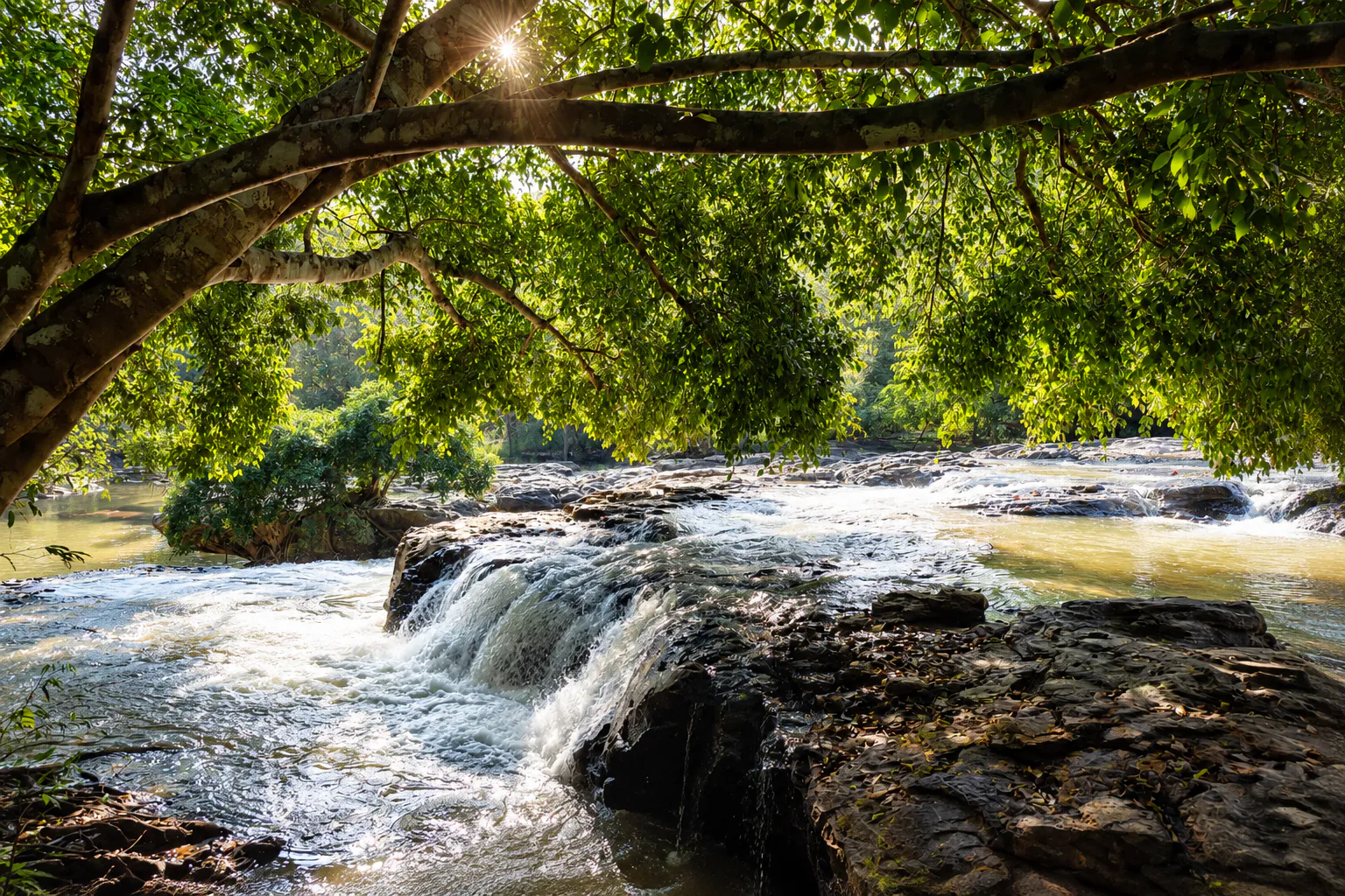
Namtok Sai Thong is the principal waterfall of the national park. Water flows through the forest before descending over the mountain landscape, and the falls are most attractive during and after the rainy season, when water levels are higher.
The DNP identifies Sai Thong Waterfall as one of the natural features that led to the area’s designation as a national park. Unlike the flower fields, which bloom in a narrow window, the waterfall changes continuously with rainfall.
Sai Thong in the Rainy Season
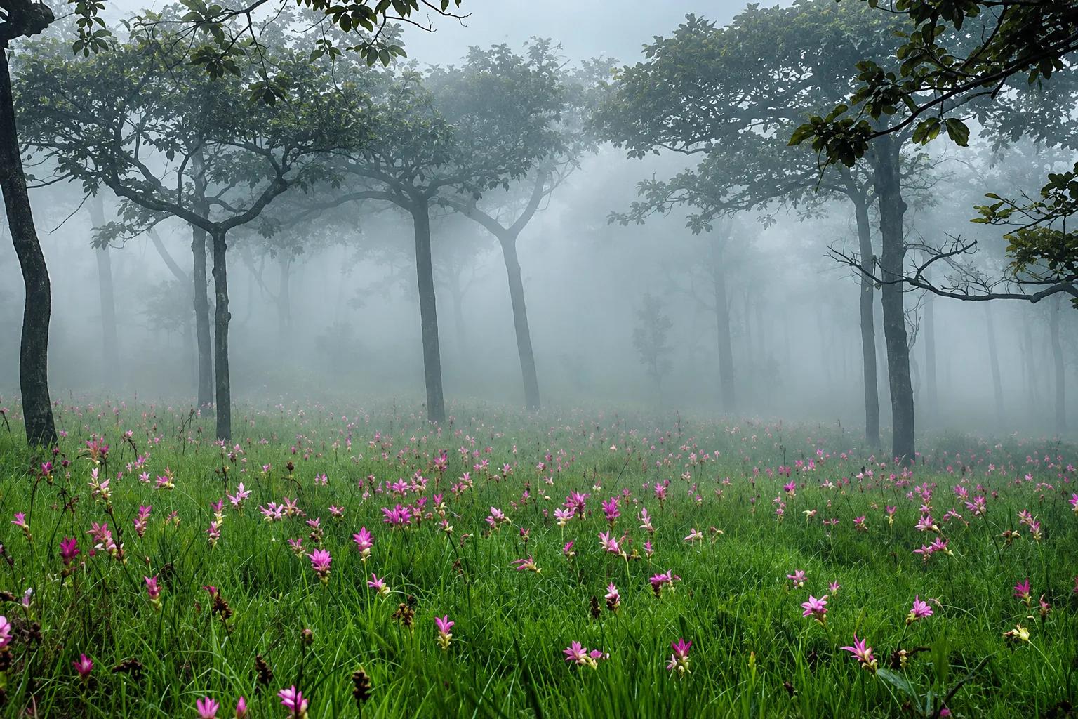
This is when the park becomes most dramatic. Rain feeds the streams. The forest turns intensely green. Clouds gather around the mountain. The Dok Krachiao begins to bloom, and the waterfall grows stronger.
Dry-season mountain → living green highland.
That seasonal transformation is one of the strongest reasons to visit.
Water & the Forest
Sai Thong is an important watershed. Its mountain forests give rise to streams including:
- Huai Pong Khun Phet
- Huai Chiang Tha
- Huai Ya
- Huai Yang
- Lam Nam Chao
- Lam Nam Chiang
These waterways form part of the drainage system connected to the Chi River. The trees capture rainfall, the soil stores water and the streams carry it downstream — so the protected forest supports both biodiversity and the communities around it.
Forests of Sai Thong
The DNP identifies three principal forest types within the park.
Dry evergreen forest
Found particularly in parts of the Phraya Pho and central Phang Hoei ranges. Typical trees include Lagerstroemia, Hopea, dipterocarp species, Afzelia, Pterocarpus, wild mango, sathon and other evergreen and semi-evergreen species.
Dry dipterocarp forest
Common on ridges and lower rolling terrain — dipterocarps, Shorea, oak-like trees, bamboo and seasonal grasses. In the dry season it looks far more open than the lush rainy-season landscape.
Mixed deciduous forest
Found in smaller areas, with Pterocarpus, Lagerstroemia, Afzelia and bamboo. The mix of forest types contributes to the park’s biodiversity.
Wildlife
Sai Thong protects a broad forest ecosystem. DNP records include:
- Mammals
- Wild boar, muntjac, chevrotain, civets, palm civets, squirrels, bamboo rats, porcupines and rabbits.
- Birds
- Greater coucals, crows, raptors, junglefowl and other forest birds.
- Reptiles & amphibians
- Monitor lizards, lizards, geckos, snakes, frogs, tree frogs and toads.
These are species recorded within the park, not guaranteed sightings.
Birdwatching
The mix of forest, grassland, streams and open mountain creates several habitats, making Sai Thong well suited to casual birdwatching. Early morning is best. Listen for calls before searching the canopy, and bring binoculars if you can.
The most rewarding encounter is an animal behaving naturally — not one you tried to get close to.
The Landscape Beyond the Flowers
A common mistake is to photograph the Dok Krachiao and leave. That misses much of the park. The flower meadow is one ecological layer; around it lie forest, water, mountain ridges, cliffs, sandstone, grasslands and wildlife habitat.
The flowers are spectacular precisely because they are part of this larger ecosystem.
Sai Thong vs Pa Hin Ngam
Similar flowers. Different experience.
These two national parks are often confused: both are in Chaiyaphum and both are famous for Dok Krachiao. TAT lists them as separate major attractions — and they reward different kinds of trip.
| Feature | Sai Thong | Pa Hin Ngam |
|---|---|---|
| Flowers | Thung Bua Sawan | Dok Krachiao fields |
| Signature | Sai Thong Waterfall | Strange sandstone formations |
| Viewpoint | Pha Pho Mueang | Lan Hin Ngam · Pha Sud Phaendin |
| Mountain | Phang Hoei Mountain (~1,008 m) | Phu Laen Kha-related landscape |
| Experience | Camping + mountain scenery | Rock formations + flower trails |
| Character | More wilderness-oriented | More attraction-focused |
The Best Time to Visit
- Jun–Aug
- Flower season. The classic Sai Thong experience — Dok Krachiao, green grasslands, mist, fresh forest and stronger waterfalls.
- Sep–Oct
- Deep green season. Forest stays lush and water levels attractive, but heavy rain can affect roads and trails. The DNP notes September as a particularly wet month.
- Nov–Feb
- Cool mountain season. Flowers are over, but the mountains are quieter — ideal for camping, hiking, photography and cooler weather.
- Mar–May
- Hot & dry. Temperatures rise, vegetation thins and water levels fall. The park may close for resource recovery and maintenance.
A Perfect Sai Thong Day
- Early morning
- Arrive and head for the highland zone — soft light, mist and cool air.
- Morning
- Explore Thung Bua Sawan in flowering season. Walk slowly rather than rushing between photo points.
- Late morning
- Continue to Pha Pho Mueang for the mountain panorama.
- Afternoon
- Visit Sai Thong Waterfall if conditions permit.
- Late afternoon
- Return to the highland or camping zone and watch the light turn warm.
A Two-Day Sai Thong Experience
For photographers and nature travellers, one night is considerably better — you see the mountain under different light.
Day 1
Arrival → Thung Bua Sawan → Pha Pho Mueang → Sai Thong Waterfall → camping
Day 2
Sunrise → forest walk → additional viewpoints → relaxed departure
Camping at Sai Thong
The DNP currently lists three visitor zones:
- Zone 1
- Park Headquarters — accommodation, camping and other facilities.
- Zone 2
- Pha Pho Mueang — about 10 km from headquarters, tent camping.
- Zone 3
- Thung Bua Sawan — about 12 km from headquarters, tent camping.
Three park houses are listed at headquarters — Sai Thong 102, 103 and 106 — along with camping areas and basic camping equipment.
Photography Guide
Dok Krachiao
Avoid shooting only individual flowers. Use flowers + grass + mountain + sky to tell the story.
Pha Pho Mueang
Add a foreground — rock, grass or tree → mountain layers — to create depth.
Waterfall
Use a slower shutter speed only if conditions allow and the camera is protected from spray. Protect equipment in the rain.
Mist
Mist is unpredictable. Don’t wait for one composition — photograph the changing scene. The mountain may vanish for five minutes and return ten minutes later.
What to Bring
Rainy-season visit
- Waterproof hiking shoes, extra socks
- Rain jacket and small umbrella
- Waterproof phone and camera protection
- Insect repellent, sunscreen, hat
- Drinking water and a power bank
- Binoculars, light jacket, small towel
Camping
- Warm layer
- Sleeping equipment if required
- Headlamp
- Personal medicine
- Waterproof bags
Weather can change quickly on exposed mountain ridges.
Getting There
Sai Thong National Park is in Chaiyaphum Province, roughly 300 km northeast of Bangkok by road depending on the route. It extends across four districts: Nong Bua Rawe, Thep Sathit, Phakdi Chumphon and Nong Bua Daeng.
From Chaiyaphum city
Drive toward Nong Bua Rawe and the park’s western and southern access areas. Because the park covers about 319 km², the exact route depends on which zone you’re heading for — Thung Bua Sawan, Pha Pho Mueang or park headquarters. Don’t treat them as a single compact attraction.
Private or rental car
The most practical option — flexibility between the park’s zones, and ideal for a wider Chaiyaphum road trip.
Public transport
Possible to surrounding communities, but much less convenient for exploring attractions inside the park.
Where to Stay
- Inside the park
- Best for sunrise, camping, photography, slow travel and early access to the flower fields — at headquarters, Pha Pho Mueang or Thung Bua Sawan.
- Chaiyaphum city
- Hotels, restaurants and more comfort — good for combining several provincial attractions.
- Thep Sathit & nearby
- Useful for travellers focusing on the southern Chaiyaphum mountain region.
Responsible Flower Tourism
Dok Krachiao is beautiful because it is a wild seasonal plant growing within a natural ecosystem.
- Do not step on flower beds, pick flowers or pull plants from the ground
- Do not create new paths or move rocks
- Do not damage vegetation for a photograph
- Do not fly drones where prohibited
- Take all rubbish out with you
The best photograph leaves the landscape exactly as you found it.
Safety on the Cliffs
Sai Thong’s cliffs are among its most dramatic features — and among its most dangerous. Wet sandstone becomes slippery, mist reduces visibility and rain can make surfaces unstable.
Never stand on an unprotected edge for a photograph. Follow barriers, signs and ranger instructions. A good landscape shot is not worth a fall.
Frequently Asked Questions
- Where is Sai Thong National Park?
- Chaiyaphum Province, northeastern Thailand — across Nong Bua Rawe, Thep Sathit, Phakdi Chumphon and Nong Bua Daeng districts.
- What is Sai Thong famous for?
- Dok Krachiao at Thung Bua Sawan, the Pha Pho Mueang cliff, Sai Thong Waterfall, mountain scenery and camping.
- When do the Dok Krachiao flowers bloom?
- From the early rainy season, with the main viewing period commonly June–August. Check current conditions before you go.
- What is Thung Bua Sawan?
- The “Heavenly Lotus Meadow” — the highland grassland where Dok Krachiao blooms, about 12 km from park headquarters.
- How high is the park?
- From about 300 m to 1,008 m; Phang Hoei Mountain is the highest point.
- Can I camp at Sai Thong?
- Yes — at headquarters, Pha Pho Mueang and Thung Bua Sawan, subject to current operating status.
- Sai Thong or Pa Hin Ngam?
- Sai Thong is larger and wilder, with waterfall, cliffs and camping. Pa Hin Ngam is more compact and known for its sandstone formations.
- Is the park ever closed?
- It may close in the hot, dry months for recovery and maintenance. In 2026 the closure was extended to 15 May — always check the latest DNP announcement.
- How long should I spend?
- One to two days. Staying a night gives you sunrise, mist and the flowers in their best light.
Essential Information
- Park
- Sai Thong National Park · อุทยานแห่งชาติไทรทอง
- Province / region
- Chaiyaphum · Northeastern Thailand (Isan)
- Districts
- Nong Bua Rawe, Thep Sathit, Phakdi Chumphon & Nong Bua Daeng
- Area
- 199,375 rai · approximately 319 km²
- Mountain ranges
- Phang Hoei & Phraya Pho
- Highest point
- Phang Hoei Mountain — approximately 1,008 m
- Established
- 30 December 1992 · National Park No. 77
- Signature flower
- Dok Krachiao / Siam tulip
- Main attractions
- Thung Bua Sawan · Pha Pho Mueang · Sai Thong Waterfall
- Best season
- Green season, particularly June–August for Dok Krachiao
- Recommended stay
- 1–2 days
- Best for
- Wildflowers, mountain scenery, camping, photography, waterfalls and nature
- Transport
- Private or rental car recommended
- Visitor centre
- +66 89 282 3437
Before You Go
Sai Thong is a seasonal mountain destination, and operating conditions can change. Before travelling, check:
- Current park opening status and seasonal closures
- Dok Krachiao flowering conditions
- Waterfall, road and weather conditions
- Camping availability
- Current access to Pha Pho Mueang and Thung Bua Sawan
More Chaiyaphum Nature
- Pa Hin Ngam National Park
- Siam tulips and natural sandstone sculptures at Lan Hin Ngam.
- Phu Laenkha National Park
- Chaiyaphum mountain forest and viewpoints near the provincial heartland.
- Nam Nao National Park
- Highland forest on the Phetchabun–Chaiyaphum corridor.
- All Nature & Parks
- Browse ThailandLover’s national park guides across the country.
Location
Find Sai Thong
Sai Thong National Park, Chaiyaphum Province, Thailand