


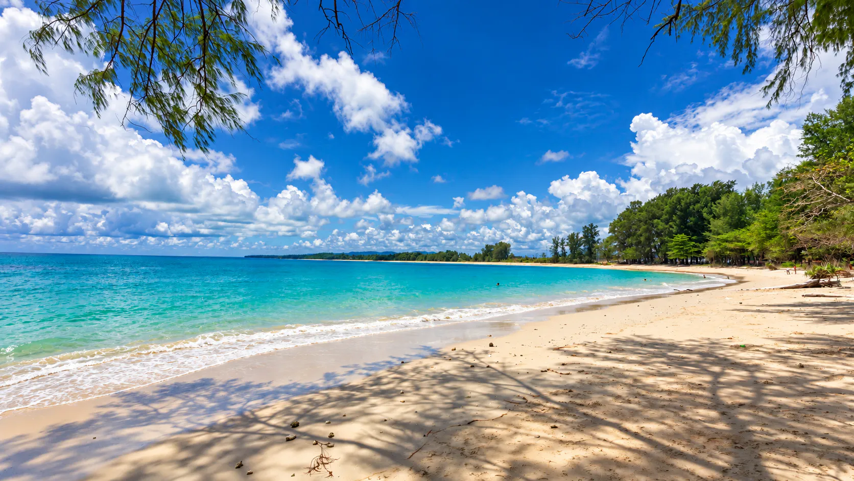

National Park · Phuket
Sirinat National Park
อุทยานแห่งชาติสิรินาถ
Where Phuket’s Forest Meets the Andaman Sea
Thalang · Northwestern Phuket · Andaman Coast
On the quieter northwestern shore, white sand, coastal pines, mangroves and coral sit inside one protected landscape — a first glimpse of natural Phuket, about a kilometre from the airport.
A Different Side of Phuket
On the northwestern coast of Phuket, where the island begins to feel quieter and more open, Sirinat National Park (อุทยานแห่งชาติสิรินาถ) protects a remarkable stretch of coastline, beach forest, coral reef and marine habitat.
Away from the dense development of the island’s major resort areas, Sirinat preserves a landscape of white-sand beaches, coastal pine forest, rocky headlands, mangrove habitat and shallow marine ecosystems.
The park is particularly important as a coastal conservation area. Its beaches have historically provided nesting habitat for sea turtles, while its coastal waters support coral reefs and a variety of marine life.
Sirinat is also unusually accessible. It lies in Thalang District, and its southern section is only about 1 kilometre from Phuket International Airport. For travellers arriving by air, this can be one of the first places where the island’s natural landscape begins.
Come for the beach. Stay for the ecosystem. Leave the coast exactly as you found it.
At a Glance
- ~90 km²
- Park area — about 56,250 rai.
- 76% water
- A marine park. Land is about 24%.
- 13 km
- Continuous sandy coastline.
- 1981
- Established — Thailand’s 31st national park.
- ~1 km
- From Phuket International Airport.
- Official Name
- Sirinat National Park
- Thai Name
- อุทยานแห่งชาติสิรินาถ
- Province
- Phuket
- District
- Thalang
- Location
- Northwestern coast of Phuket
- Area
- Approximately 90 km² / 56,250 rai
- Marine Area
- Approximately 76%
- Land Area
- Approximately 24%
- Coastline
- Approximately 13 km of continuous sandy beaches
- National Park Status
- Established in 1981
- Former Name
- Nai Yang Beach National Park
- Best Known For
- Beaches, coastal pine forest, coral reefs, sea turtles and marine ecosystems
- Closest Major Airport
- Phuket International Airport
- Best For
- Beach relaxation, nature, coastal walks, photography and wildlife
The Department of National Parks records the park at approximately 90 square kilometres, of which about 76% is water and 24% is land.
Why Visit Sirinat National Park?
Sirinat is not a mountain national park. It is not a jungle destination built around waterfalls. Its identity comes from the meeting point between land and sea.
The park protects a sequence of beaches and coastal landscapes along Phuket’s northwestern shoreline, where beach forest, sand, rocky headlands, coral reef and shallow marine environments occur within the same protected landscape.
This makes Sirinat particularly interesting for travellers who want a quieter natural experience without travelling far from Phuket’s main infrastructure.
The experience is simple: walk beneath coastal trees → reach the beach → watch the Andaman Sea → explore the shoreline → look for wildlife.
The Coastline
Thirteen kilometres of connected sand
One of Sirinat’s defining characteristics is its long sandy coastline. The Department of National Parks describes approximately 13 kilometres of connected sandy beaches, extending from the northern part of the park toward Nai Yang in the south.
- Tha Chatchai Beach
- Sai Kaew Beach
- Mai Khao Beach
- Nai Yang Beach
- Shorter beaches around rocky headlands, including areas around Nai Thon
The exact character of each section changes according to coastal geology, currents and sediment movement. Some sections are broad sandy beaches. Others are associated with rocky headlands, exposed rock platforms or small coastal bays. This variation is one of the reasons the park is more interesting than a single conventional beach destination.
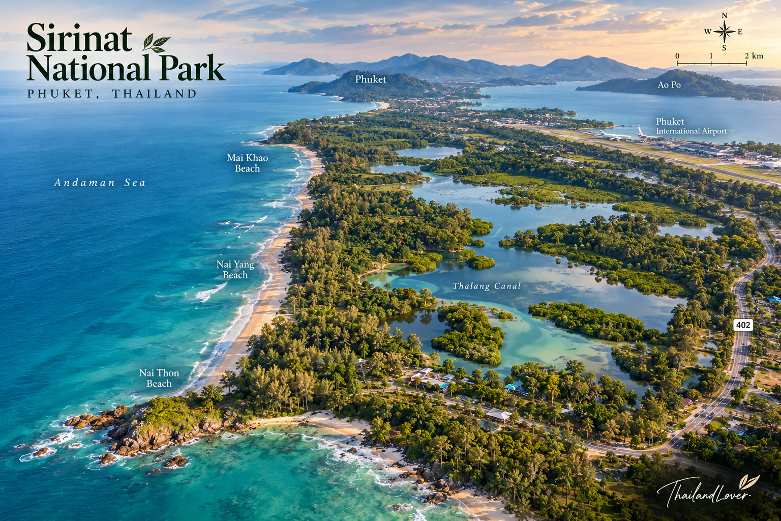
Nai Yang Beach
หาดนายยาง · the heart of Sirinat
Nai Yang Beach is the best-known beach associated with Sirinat National Park. The beach is backed by a distinctive belt of coastal pine trees, creating a naturally shaded landscape that feels markedly different from Phuket’s more intensively developed resort beaches.
The Tourism Authority of Thailand describes Nai Yang as a beach within Sirinat National Park with a shady pine grove, coral reef and marine life. It also identifies the area as historically associated with sea-turtle nesting.
Nai Yang works particularly well for travellers who want:
- A quieter beach environment
- Shade beneath coastal trees
- A natural setting close to the airport
- A place for sunset and beach photography
- Easy access to the broader Sirinat landscape
The beach is also a useful starting point for understanding why this coastline was protected in the first place.
Mai Khao Beach
หาดไม้ขาว · Phuket’s long northern beach
Mai Khao Beach forms part of the long sandy coastline in the northern section of Sirinat’s protected landscape. Compared with Phuket’s more urbanised beaches, Mai Khao has a much greater sense of open space.
The northern coastline is also close to Phuket International Airport. This has made Mai Khao famous for aircraft photography, but the beach itself should not be reduced to an airport viewpoint. The more important story is the coastal ecosystem: beach, vegetation, sand movement and shallow marine habitat form a continuous natural system.
Sai Kaew Beach
หาดทรายแก้ว · the northern edge of Phuket
Sai Kaew Beach (Hat Sai Kaew) lies toward the northern part of the protected coastal landscape. The beach is characterised by a relatively open sandy shoreline backed by coastal vegetation. It forms part of the transition between the beaches of northern Phuket and the mainland-facing area around Tha Chatchai.
For travellers driving into Phuket from the north, this section of coastline provides an early introduction to the island’s less-developed northern landscape.
Tha Chatchai
Where the island meets the mainland
Tha Chatchai occupies the northern end of Phuket, close to the Sarasin Bridge area. The landscape here is different from the open beaches farther south. Coastal forest, tidal environments and waterways become more prominent, illustrating how Phuket’s northern end transitions from open Andaman coastline into more sheltered coastal environments.
This area is also important in understanding Phuket’s geographic relationship with the mainland.
Nai Thon
A smaller coastal landscape
The park’s wider coastal geography also includes smaller beaches and rocky sections around the headlands south of the main sandy coastline. Nai Thon is associated with one of these more enclosed coastal environments. The landscape here is more intimate than the broad open beaches of Mai Khao and Nai Yang.
The Department of National Parks describes several short beaches occurring between rocky headlands, formed partly from sand generated through erosion and coastal processes.
The park is not simply a single long beach. It contains several different coastal landforms.
Coastal Pine Forest
The characteristic green edge of the beach
One of Sirinat’s most distinctive ecological features is its beach forest. This vegetation forms a relatively narrow belt along parts of the coastline and acts as a natural buffer against wind and coastal conditions.
The Department of National Parks records species associated with the beach forest including:
- Casuarina equisetifolia
- Sea almond
- Banyan and fig species
- Barringtonia
- Calophyllum
- Pandanus
- Beach hibiscus
- Tropical shrubs and vines
Ferns, orchids and other epiphytic plants can also occur within the coastal vegetation. The result is a landscape that feels distinctly tropical but remains closely connected to the sea.
Mangrove Forest
The other side of the coast
Not all of Sirinat is open beach. Mangrove vegetation occurs around tidal waterways and areas influenced by seawater. Recorded mangrove species include Rhizophora, Bruguiera, Ceriops, Avicennia, Sonneratia and Xylocarpus.
Mangroves are important nursery habitats for juvenile marine organisms and also help stabilise coastal environments. They are an important part of Sirinat’s ecological story even though visitors may associate the park primarily with beaches.
Coral Reefs & Marine Life
Sirinat also protects marine environments offshore. The Department of National Parks identifies coral reefs and rocky coastal formations among the park’s natural features. The shallow marine environment supports reef fish, molluscs, crustaceans, other marine invertebrates and coral communities.
The reef is not simply an attraction for snorkelling. It is part of the coastal system that reduces wave energy and influences the formation and stability of nearby beaches.
Sea Turtles
A protected coastal nursery
Sea turtles are one of the most important conservation stories associated with Sirinat. The park was originally surveyed for protection partly because sections of its beaches were used by sea turtles for nesting.
The Tourism Authority of Thailand specifically identifies Nai Yang Beach as an area historically associated with sea-turtle nesting, particularly during approximately November to February. It also notes that the turtle population has declined considerably.
If you encounter a sea turtle:
- Keep your distance
- Never touch it
- Do not block its route to the sea
- Avoid flash photography
- Keep noise low
- Never disturb nesting areas
- Follow instructions from park officers
The best wildlife encounter is one that leaves the animal completely undisturbed.
Other Marine Creatures
The Department of National Parks also highlights the presence of marine invertebrates and coastal species in the park’s waters. Historically, the area has been noted for sand cicadas, rare marine shells and other coastal organisms. These smaller creatures are easy to overlook. For visitors interested in natural history, they provide a much better understanding of the park than simply photographing the beach.
Look carefully around rocky tide pools, sandy shorelines, vegetation near the high-tide line and shallow coastal water. Always observe without collecting.
Geography & Geology
Sirinat contains several distinct landforms. The inland portions include granite mountain formations associated with Khao Ruak, Khao Mueang and Khao Sai Kru. The Department of National Parks records the highest point around 335 metres at Khao Sai Kru, while Khao Mueang reaches approximately 295 metres.
Along the coast, erosion and deposition have created sandy beaches, rocky shores, coastal terraces, headlands, shallow marine areas and sand accumulation zones. This combination explains why different sections of Sirinat can look surprisingly different despite being part of one national park.
A Park Mostly Made of Water
One of Sirinat’s most interesting facts is easy to miss. Approximately three-quarters of the park is marine area.
- Water · ~76%
- Coral, rocky coast and shallow Andaman habitat.
- Land · ~24%
- Beach, pine forest, mangroves and low granite hills.
Sirinat is a marine and coastal national park. The beach is only the visible edge of a much larger protected ecosystem.
The Story Behind the National Park
Sirinat National Park was originally established as Nai Yang Beach National Park. During the 1970s, the Thai government was developing Phuket as an international tourism destination. At the same time, the government and forestry authorities recognised the need to protect the island’s remaining natural coastal landscapes.
Initial surveys focused on the natural beach forests and beaches around Hat Sai Kaew → Mai Khao → Nai Yang, covering roughly 13 kilometres of coastline. The area was considered suitable for national-park protection because of its natural beach forest, white sandy beaches, coral reefs, rocky formations, sea-turtle nesting habitat and marine biodiversity.
The national park was formally established by Royal Decree in 1981, becoming Thailand’s 31st national park.
From Nai Yang to Sirinat
In 1990, the Cabinet approved adding an area at Tha Chatchai to the protected area. The expanded area was associated with a royal commemoration of Her Majesty Queen Sirikit’s fifth-cycle birthday in 1992. The park subsequently received its new name: Sirinat National Park.
Today, the name Sirinat is associated with one of Phuket’s most important protected coastal landscapes.
Climate
Sirinat has a humid tropical coastal climate, strongly influenced by the southwest monsoon, which brings moist air from the Indian Ocean.
- May – September
- Substantial rainfall under the southwest monsoon. Sea conditions can become rougher, and beach activities require greater caution.
- November – April
- The southwest monsoon weakens and the northeast monsoon becomes more influential. Temperatures remain warm throughout the year.
The Department of National Parks records an average maximum temperature of approximately 29°C in April and an average minimum of approximately 27°C in December. Because Sirinat is coastal, weather and sea conditions can change rapidly.
Best Time to Visit
- November – February
- A particularly attractive period for beach walks, coastal photography, sea-turtle conservation, outdoor activities and lower rainfall. This period also overlaps the historical sea-turtle nesting season identified by the Tourism Authority of Thailand.
- March – April
- Hotter conditions. Early morning and late afternoon are more comfortable for outdoor exploration.
- May – October
- The southwest monsoon brings wetter conditions and rougher seas. The landscape becomes lush, but swimming and water activities should be approached with considerably more caution.
Always follow current beach-warning flags and park instructions.
Best Things to Do
- 1. Walk the beach
- A simple walk along the coast is one of the best ways to experience the park. Look beyond the water. Observe the relationship between sand → coastal forest → reef → sea.
- 2. Relax beneath the casuarinas
- Nai Yang’s coastal trees provide one of the park’s defining visual characteristics.
- 3. Explore the coastal landscape
- Walk where permitted and observe changes in sand, rock and vegetation.
- 4. Nature photography
- Beach landscapes, coastal forests, sunset, macro photography, marine-life photography and wildlife observation.
- 5. Look for wildlife
- Birds, insects, marine invertebrates and other smaller animals are often easier to encounter than large wildlife.
- 6. Learn about sea-turtle conservation
- The turtle story is an important part of the park’s identity. If conservation information or seasonal activities are available, they add considerable context to a visit.
Swimming & Sea Conditions
Some sections of Sirinat’s beaches can be suitable for swimming when conditions are calm. The Andaman Sea is highly seasonal. During the southwest monsoon, waves and currents can become significantly stronger.
Photography Guide
- Nai Yang
- Use the casuarina trees as foreground elements against the sea.
- Mai Khao
- The long beach works particularly well for minimalist landscape photography.
- Tha Chatchai
- Look for coastal vegetation, tidal landscapes and the northern transition of the island.
- Sunset
- The west-facing coastline provides excellent opportunities for sunset photography.
- Wildlife
- Use a telephoto lens rather than approaching animals. For sea turtles especially, maintain a respectful distance.
A Different Side of Phuket
Sirinat is particularly valuable because of its location. Phuket is one of Thailand’s most developed tourism destinations, yet the island still contains protected stretches where natural coastal processes can be observed.
Within a relatively short distance you can move from airport → resort infrastructure → protected beach forest → coral reef → open Andaman Sea. That transition is part of the attraction.
How to Get There
Sirinat National Park is in Thalang District on Phuket’s northwestern coast. It is exceptionally accessible compared with many Thai national parks.
- From Phuket International Airport
- The park is approximately 1 kilometre from the airport in its nearest section. Nai Yang is particularly convenient for travellers arriving or departing by air.
- From Phuket Town
- Travel north along the island’s main road network toward Thalang and Phuket International Airport, then follow signs toward the relevant beach or park entrance.
- By car
- The easiest option for exploring multiple sections of the park.
- By taxi / ride-hailing
- Practical for Nai Yang and other major beach areas. Visiting several less-developed sections is easier with private transport.
Suggested Itinerary
- Half day
- Phuket Airport → Nai Yang Beach → coastal forest → sunset. Ideal for travellers with limited time.
- One day
- Morning: Nai Yang Beach, coastal forest, and the marine and beach environment. Afternoon: drive north through Mai Khao and Sai Kaew toward Tha Chatchai, then return for sunset.
- Two days
- Combine Sirinat with northern Phuket and allow more time for beach walks, nature observation, photography, local food and conservation experiences.
What to Bring
- Water
- Sun protection, hat and sunglasses
- A reef-safe approach to marine activities
- Comfortable sandals or shoes
- Insect repellent
- Light rain protection
- Waterproof protection for electronics
- Binoculars if birdwatching
- Camera
For longer beach walks, carry enough drinking water because shade and services vary by location.
Responsible Travel
Sirinat’s greatest value is ecological. Visitors can help protect it by:
- Taking rubbish with you
- Avoiding single-use plastics where possible
- Never collecting shells or marine life
- Never touching coral
- Never feeding wildlife
- Staying away from turtle nests
- Keeping dogs and other animals away from sensitive nesting areas where regulations require
- Avoiding loud noise at wildlife areas
- Following park closures and beach-warning systems
- Never driving vehicles onto protected beaches unless specifically permitted
The sand, shells, coral and wildlife belong to the ecosystem.
Sirinat for Families
Sirinat can work particularly well for families because much of the experience does not require strenuous hiking. A simple family day can involve a coastal walk → the beach → a picnic where permitted → nature observation → sunset.
Children can learn to identify casuarina trees, crabs, shells without collecting them, coastal birds, different types of shoreline and mangrove plants. The park provides an opportunity to introduce children to conservation without turning the visit into a formal classroom.
Sirinat for Nature Lovers
For nature-focused travellers, Sirinat is more interesting than its beach reputation suggests. Look for the ecological layers:
- Beach
- Sand, shells, coastal organisms and nesting habitat.
- Beach forest
- Casuarina and other salt-tolerant vegetation.
- Mangrove
- Tidal forest and nursery habitat.
- Reef
- Corals and marine organisms.
- Offshore waters
- A broader marine ecosystem connected to the Andaman Sea.
The park’s value lies in the connection between all of these environments.
Sirinat vs. Phuket’s Resort Beaches
Sirinat is not designed to compete with Phuket’s major resort beaches in terms of nightlife, shopping or entertainment. Its appeal is different. The two can coexist in a Phuket itinerary.
| Sirinat | Resort beach | |
|---|---|---|
| Landscape | Protected natural landscape | Highly developed |
| Shoreline | Coastal forest | Buildings and commercial facilities |
| Purpose | Marine conservation | Recreation-focused |
| Wildlife | Wildlife habitat | Tourism infrastructure |
| Atmosphere | Quiet sections | Busy activity |
| Experience | Nature experience | Resort experience |
You do not have to choose between Phuket’s modern tourism infrastructure and its natural heritage. Sirinat lets you experience both sides of the island.
Essential Information
- Park
- Sirinat National Park · อุทยานแห่งชาติสิรินาถ
- Province
- Phuket
- District
- Thalang
- Location
- Northwestern Phuket
- Area
- Approximately 90 km²
- Land
- Approximately 24%
- Marine area
- Approximately 76%
- Coastline
- Approximately 13 km
- Established
- 1981
- Former name
- Nai Yang Beach National Park
- Key landscapes
- Nai Yang Beach, Mai Khao Beach, Sai Kaew Beach, Tha Chatchai, coastal beach forest, mangrove areas, coral reef and rocky coastal formations
- Best for
- Beaches · coastal forest · marine ecology · sea turtles · nature photography · wildlife · relaxation
- Official information
- Department of National Parks, Wildlife and Plant Conservation
Before You Go
Sirinat is a protected national park, so access conditions, swimming areas, conservation measures, entrance arrangements and facilities can change. Always check current information from the Department of National Parks before travelling, particularly during the monsoon season.
For wildlife encounters, especially sea turtles, treat conservation as the priority rather than trying to obtain a photograph.
Come for the beach.
Stay for the ecosystem.
Leave the coast exactly as you found it.
Frequently Asked Questions
- What is Sirinat National Park?
- A marine and coastal national park on northwestern Phuket — white-sand beaches, coastal pine forest, rocky headlands, mangroves, coral reefs and shallow marine habitat, away from the major resort strips.
- Where is it, and how large is it?
- Thalang District. About 90 km² (56,250 rai): roughly 76% water and 24% land, with about 13 km of sandy coast. The nearest section is about 1 km from Phuket International Airport.
- Which beaches are in the park?
- Tha Chatchai, Sai Kaew, Mai Khao and Nai Yang, plus shorter beaches around rocky headlands, including Nai Thon. Nai Yang is the best-known, backed by coastal pines.
- Can I see sea turtles?
- Nai Yang was historically a nesting beach, especially from about November to February, and the population has declined considerably. Visit for the habitat. If you encounter a turtle, keep your distance and follow park officers.
- When is the best time to visit?
- November to February for beach walks, photography and lower rainfall. March–April is hotter. May–October is wetter, with rougher seas. Follow beach-warning flags.
- How do I get there from the airport?
- About 1 kilometre to the nearest section. Nai Yang is especially convenient on arrival or departure. A car is best if you want several stretches of the coast.
- What was it called before?
- Nai Yang Beach National Park, established by Royal Decree in 1981 as Thailand’s 31st national park. It was later renamed Sirinat after the Tha Chatchai area was added, in association with Queen Sirikit’s fifth-cycle birthday in 1992.
More of the Andaman Coast
- Khao Lak–Lam Ru National Park
- Rainforest mountains, waterfalls and protected Andaman beaches just north of Phuket.
- Ao Phang Nga National Park
- Limestone islands and sheltered bay water on the other side of Phuket.
- Si Phang-nga National Park
- Rainforest waterfalls and forest streams in the quiet inland heart of Phang Nga.
- Mu Ko Similan National Park
- The Andaman’s famous island park, reached by boat from the Phang Nga coast.
- Laem Son National Park
- Casuarina beaches, mangroves and reefs along a long, quieter Andaman shore.
Location
Find Sirinat National Park
Thalang, northwestern Phuket · Nai Yang and Mai Khao lie along the coast beside Phuket International Airport